The exact coordinates of Lacombe Louisiana for your GPS track:
Latitude 30.301947 North, Longitude 89.920776 West.
Please share the link with friends and neighbors:
Share on Facebook
Share on WhatsApp
Share on Telegram
Share on Facebook
Share on WhatsApp
Share on Telegram
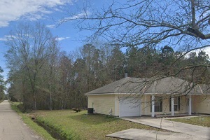
An image of Lacombe
More city maps of Louisiana:
- Map of New Orleans
New Orleans is a city located in the southeastern state of Louisiana, in the United States. It is ... - Map of Lafayette
Lafayette is the fourth largest city in Louisiana with population of over 120 thousand people. It ... - Map of Houma
Houma is a city in southern Louisiana with 33 thousand inhabitants. It was incorporated in 1848 an... - Map of Prairieville
Prairieville, Louisiana is a nice CDP located 18 miles southeast of Baton Rouge, in Ascension Pari... - Map of New Iberia
New Iberia, Louisiana is a lovely city, seat of Iberia Parish. Incorporated in 1839, today New Ibe... - Map of Harvey
Harvey, Louisiana is a shining CDP situated south of New Orleans, in Jefferson Parish. Today Harve... - Map of Gretna
Gretna, Louisiana is a shining city located in Jefferson Parish and serving as the parish seat. It... - Map of Pineville
Pineville, Louisiana is a shining city located in Rapides Parish, across the Red River from the la... - Map of Baker
Baker, Louisiana is a wonderful city situated in East Baton Rouge Parish. It stands in the southea... - Map of Morgan City
Morgan City, Louisiana is a wonderful city situated mostly in St. Mary Parish. It stands on the ba... - Map of Waggaman
Waggaman is a pleasant unincorporated community located in Jefferson Parish in southeastern Louisi... - Map of Timberlane
Timberlane is a charming CDP located within Jefferson Parish in southeastern Louisiana. It is situ... - Map of Jennings
Jennings is a shining city that serves as the parish seat of Davis Parish in southwestern Louisian... - Map of Merrydale
Merrydale, Louisiana is a census-designated place in East Baton Rouge Parish. It is situated in th... - Map of Scott
Scott, Louisiana is a lovely city situated in Lafayette Parish. It stands in the southwestern part... - Map of Galliano
Galliano, Louisiana is a shining community located in Lafourche Parish. It stands in the southern ... - Map of Inniswold
Inniswold, Louisiana is a census-designated place located in East Baton Rouge Parish. It is part o...
Full list of Louisiana maps
This online map of Lacombe, Louisiana is provided by Bing Maps. Please add a bookmark and share the page with your friends!