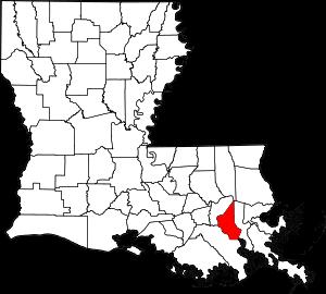
St. Charles Parish on the map of Louisiana 2026. Cities, roads, borders and directions in St. Charles Parish of Louisiana.
USA / Louisiana / St. Charles ParishSt. Charles Parish is found in the southeastern zone of Louisiana. This nice parish is named after Saint Charles. The overall population of St. Charles Parish reaches 52 thousand people. The parish, formed in 1807, covers an area of 410 square miles. The parish seat of St. Charles Parish is Hahnville. This map shows the borders of St. Charles Parish as well as neighboring counties, including major highways and natural objecsts as of 2026. Zoom in or out of the map using the plus/minus panel. Move the center of this map by dragging it. Also check out the satellite map of St. Charles Parish.
The borders of St. Charles Parish over the map of Louisiana
Explore some more counties of Louisiana:
- Winn Parish
- West Feliciana Parish
- West Carroll Parish
- West Baton Rouge Parish
- Webster Parish
- Washington Parish
- Vernon Parish
- Vermilion Parish
- Union Parish
- Terrebonne Parish
- Tensas Parish
- Tangipahoa Parish
- St. Tammany Parish
- St. Mary Parish
- St. Martin Parish
- St. Landry Parish
- St. John the Baptist Parish
- St. James Parish
- St. Helena Parish
- St. Bernard Parish
Full list of Louisiana maps
This online map of St. Charles Parish, Louisiana is provided by Bing Maps. Please add a bookmark and share the page with your friends!
© 2026 City maps and famous places