Barnstable County on the map of Massachusetts 2025. Cities, roads, borders and directions in Barnstable County of Massachusetts.
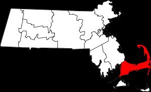
USA / Massachusetts / Barnstable CountyBarnstable County is a coastal county located on the eastern edge of Massachusetts. This respectable county tracks its history back to 1685. The shire town of Barnstable County is Barnstable. The population of Barnstable County is about 232 thousand inhabitants. The total area of the county exceeds 396 square miles. This map shows the borders of Barnstable County as well as neighboring counties, including major highways and natural objecsts as of 2025. Zoom in or out of the map using the plus/minus panel. Move the center of this map by dragging it. Also check out the satellite map of Barnstable County.
The borders of Barnstable County over the map of Massachusetts
Explore some more counties of Massachusetts:
- Plymouth County
- Norfolk County
- Nantucket County
- Hampshire County
- Hampden County
- Franklin County
- Dukes County
- Bristol County
- Berkshire County
- Suffolk County
- Essex County
- Worcester County
- Middlesex County
Full list of Massachusetts maps
This online map of Barnstable County, Massachusetts is provided by Bing Maps. Please add a bookmark and share the page with your friends!
© 2025 City maps and famous places