The exact coordinates of Ludlow Massachusetts for your GPS track:
Latitude 42.159172 North, Longitude 72.474556 West.
Please share the link with friends and neighbors:
Share on Facebook
Share on WhatsApp
Share on Telegram
Share on Facebook
Share on WhatsApp
Share on Telegram
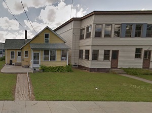
An image of Ludlow
More city maps of Massachusetts:
- Map of Boston
Boston is the capital and largest city of the state of Massachusetts, located in the northeastern ... - Map of Worcester
Worcester is located in central Massachusetts. Its population is well over 250 thousand inhabitant... - Map of Springfield
Springfield, Massachusetts is a city with 153 thousand inhabitants, located upon the banks of Conn... - Map of Somerville
Somerville, Massachusetts is a large northwestern suburb of Boston with 80 thousand residents. The... - Map of Malden
Malden, Massachusetts, incorporated 1649, is a suburb of Boston with 60 thousand residents. The ci... - Map of Revere
Revere, Massachusetts is a suburban city of Boston, situated in Suffolk County. Today Revere is po... - Map of Arlington
Arlington, Massachusetts is a suburban town of Boston, located in Middlesex County. Arlington is h... - Map of Fitchburg
Fitchburg, Massachusetts is a nice city situated in Worcester County, about 47 miles northwest of ... - Map of Shrewsbury
Shrewsbury, Massachusetts is a stylish town found near Worcester, in Worcester County. The populat... - Map of Watertown
Watertown, Massachusetts is a suburban city of Boston, located in Middlesex County. Founded back i... - Map of Franklin
Franklin, Massachusetts is an old historic city located in Norfolk County. Founded back in 1660, t... - Map of North Attleborough
North Attleborough, Massachusetts is a beautiful town situated 42 miles southwest of Boston, in B... - Map of Melrose
Melrose, Massachusetts is a stylish city found in Middlesex County, about 9 miles north of downtow... - Map of West Springfield
West Springfield, Massachusetts is a beautiful city located in Hampden County. Incorporated in 177... - Map of Belmont
Belmont, Massachusetts is a suburban town of Boston situated in Middlesex County. Incorporated in ... - Map of Easton
Easton, Massachusetts is an attractive city located 30 miles south of Boston, in Bristol County. I... - Map of Westford
Westford, Massachusetts is a wonderful town situated 35 miles northwest of Boston, in Middlesex Co...
Full list of Massachusetts maps
This online map of Ludlow, Massachusetts is provided by Bing Maps. Please add a bookmark and share the page with your friends!