The exact coordinates of South Laurel Maryland for your GPS track:
Latitude 39.067654 North, Longitude 76.847595 West.
Please share the link with friends and neighbors:
Share on Facebook
Share on WhatsApp
Share on Telegram
Share on Facebook
Share on WhatsApp
Share on Telegram
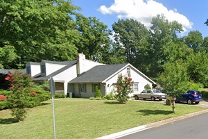
An image of South Laurel
More city maps of Maryland:
- Map of Gaithersburg
Gaithersburg AKA Gburg is a beautiful city in central Maryland with 68 thousand residents. It was ... - Map of Waldorf
Waldorf, Maryland is a large unincorporated city (CDP) in in Charles County. Its population exceed... - Map of Bowie
Bowie, Maryland (Incorporated 1882) is a city in Prince George's County, home to 58 thousand resid... - Map of Severn
Severn, Maryland is a CDP in Anne Arundel County with 49 thousand residents. It is located 10 mile... - Map of Wheaton
Wheaton, Maryland is a CDP with 52 thousand residents, located in Montgomery County. It is a north... - Map of Woodlawn
Woodlawn, Maryland is a beautiful suburban CDP of Baltimore, located in Baltimore County. Woodlawn... - Map of Annapolis
Annapolis is the capital city of Maryland, located on the coasts of Chesapeake Bay, in Anne Arunde... - Map of Olney
Olney, Maryland is a CDP situated about 18 miles north to Washington, DC, in Montgomery County. Ol... - Map of Salisbury
The city of Salisbury, Maryland is the county seat of Wicomico County. Salisbury is populated thes... - Map of Eldersburg
Eldersburg, Maryland is a nice CDP located 30 miles morthwest of Baltimore, in Carroll County. Fou... - Map of Laurel
Laurel, Maryland is a wonderful city situated in Prince George's County. Incorporated in 1870, tod... - Map of Suitland
Suitland, Maryland is a charming CDP found near Washington DC, in Prince George's County. The popu... - Map of Arnold
Arnold, Maryland is a coastal CDP located 22 miles south of Baltimore, in Anne Arundel County. Tod... - Map of Elkridge
Elkridge, Maryland is a beautiful CDP situated in Howard County. Today Elkridge is populated by 22... - Map of Langley Park
Langley Park, Maryland is a shining unincorporated community located in Prince George's County. It... - Map of Cumberland
Cumberland is a city located in Allegany County, Maryland. It stands in the western part of the st... - Map of Redland
Redland, Maryland is a wonderful CDP located in Montgomery County. It stands in the central part o...
Distances from South Laurel, Maryland:
- Distance between South Laurel and Gaithersburg
- Distance between South Laurel and Waldorf
- Distance between South Laurel and Bowie
- Distance between South Laurel and Severn
- Distance between South Laurel and Wheaton
- Distance between South Laurel and Woodlawn
- Distance between South Laurel and Annapolis
- Distance between South Laurel and Olney
- Distance between South Laurel and Salisbury
- Distance between South Laurel and Eldersburg
- Distance between South Laurel and Laurel
- Distance between South Laurel and Suitland
- Distance between South Laurel and Arnold
- Distance between South Laurel and Elkridge
- Distance between South Laurel and Langley Park
- Distance between South Laurel and Cumberland
- Distance between South Laurel and Redland
Full list of Maryland maps
This online map of South Laurel, Maryland is provided by Bing Maps. Please add a bookmark and share the page with your friends!