Watonwan County on the map of Minnesota 2026. Cities, roads, borders and directions in Watonwan County of Minnesota.
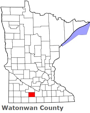
USA / Minnesota / Watonwan CountyWatonwan County is located in the southern section of Minnesota. This well known county is named after Watonwan River that flows through Minnesota. The county seat of Watonwan County is St. James. The county's area is about 435 square miles. Founded in 1860, today Watonwan County is home to 11 thousand residents. This map shows the borders of Watonwan County as well as neighboring counties, including major highways and natural objecsts as of 2026. Zoom in or out of the map using the plus/minus panel. Move the center of this map by dragging it. Also check out the satellite map of Watonwan County.
The borders of Watonwan County over the map of Minnesota
Explore some more counties of Minnesota:
- Yellow Medicine County
- Wright County
- Winona County
- Wilkin County
- Washington County
- Waseca County
- Wadena County
- Wabasha County
- Traverse County
- Todd County
- Swift County
- Stevens County
- Steele County
- Stearns County
- Sibley County
- Sherburne County
- Scott County
- Saint Louis County
- Roseau County
- Rock County
Full list of Minnesota maps
This online map of Watonwan County, Minnesota is provided by Bing Maps. Please add a bookmark and share the page with your friends!
© 2026 City maps and famous places