The exact coordinates of Bridgeton Missouri for your GPS track:
Latitude 38.753685 North, Longitude 90.41581 West.
Please share the link with friends and neighbors:
Share on Facebook
Share on WhatsApp
Share on Telegram
Share on Facebook
Share on WhatsApp
Share on Telegram
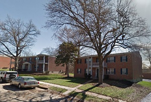
An image of Bridgeton
More city maps of Missouri:
- Map of St. Louis
St. Louis is a city located in the eastern part of the state of Missouri, in the United States. It... - Map of St. Joseph
St. Joseph, Missouri is a nice city and the county seat of Buchanan County. St. Joseph is home to ... - Map of Joplin
Joplin, Missouri is a beautiful city situated in Jasper County. Today Joplin is populated by 52 th... - Map of Wildwood
Wildwood, Missouri is a wonderful city situated in Louis County. Today Wildwood is populated by 35... - Map of Raytown
Raytown, Missouri is a shining city located in Jackson County. It is a suburb of Kansas City, loca... - Map of Grandview
Grandview is a city located in Jackson County, about 10 miles south of downtown Kansas City. Grand... - Map of Webster Groves
Webster Groves, Missouri is a wonderful city situated in St. Louis County, about 10 miles west of ... - Map of Affton
Affton, Missouri is a CDP situated in St. Louis County. It stands in the southwestern part of the ... - Map of Farmington
Farmington, Missouri is a pleasant city found in St. Francois County, approximately 70 miles south... - Map of Lake St. Louis
Lake St. Louis, Missouri is a charming city located in St. Charles County. It stands in the easter... - Map of Fort Leonard Wood
Fort Leonard Wood is a United States Army installation located in the Pulaski County region of cen... - Map of Moberly
Moberly, Missouri is a wonderful city situated in Randolph County, approximately 35 miles north of... - Map of Fulton
Fulton, Missouri is a pleasant city found in Callaway County. It stands in the central part of th... - Map of Union
Union, Missouri is a lovely city located in Franklin County. It stands in the eastern part of Miss... - Map of Kennett
Kennett, Missouri is a city located in Dunklin County. It stands in the southeastern part of Misso...
Full list of Missouri maps
This online map of Bridgeton, Missouri is provided by Bing Maps. Please add a bookmark and share the page with your friends!