The exact coordinates of Kirksville Missouri for your GPS track:
Latitude 40.19471 North, Longitude 92.582085 West.
Please share the link with friends and neighbors:
Share on Facebook
Share on WhatsApp
Share on Telegram
Share on Facebook
Share on WhatsApp
Share on Telegram
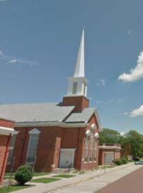
An image of Kirksville
More city maps of Missouri:
- Map of Kansas City
Kansas City is located in the western part of the state of Missouri. Kansas City's total populatio... - Map of Columbia
Columbia, Missouri (founded 1820) is the fourth largest municipality in the state and home to 116 ... - Map of O'Fallon
O'Fallon is a city on the eastern border of Missouri, located in St. Charles County. The populatio... - Map of Blue Springs
Blue Springs, Missouri is an eastern suburb of Kansas City, situated in Jackson County. Today Blue... - Map of Wentzville
Wentzville, Missouri is a stylish city found about 40 miles northwest to St. Louis, in St. Charles... - Map of Ballwin
Ballwin, Missouri is a suburban city located in St. Louis County. The population of Ballwin exceed... - Map of Mehlville
Mehlville is a census-designated place and a suburb of St. Louis, Missouri, located in St. Louis C... - Map of Belton
Belton is a city in Cass County, Missouri. It is a suburb of Kansas City and is located about 30 m... - Map of Sedalia
Sedalia, Missouri is a charming city found in Pettis County, about 95 miles east of Kansas City. T... - Map of Creve Coeur
Creve Coeur, Missouri is a charming city found in St. Louis County. It is situated in the central ... - Map of Lemay
Lemay, Missouri is an adorable unincorporated community located in St. Louis County. It stands in ... - Map of Carthage
Carthage, Missouri is a lovely city found in Jasper County. It stands in the southwestern part of ... - Map of Jennings
Jennings, Missouri is a charming city found in St. Louis County. It stands in the eastern part of ... - Map of Festus
Festus is a city located in Jefferson County, Missouri. It stands in the eastern part of the state... - Map of Troy
Troy, Missouri is a shining city located in Lincoln County. It stands in the eastern part of Miss... - Map of Eureka
Eureka is a beautiful city located in St. Louis County, Missouri. It stands in the eastern part of... - Map of Bolivar
The city of Bolivar, Missouri the county seat of Polk County. It stands in the southwestern part o...
Distances from Kirksville, Missouri:
- Distance between Kirksville and Kansas City
- Distance between Kirksville and Columbia
- Distance between Kirksville and O'Fallon
- Distance between Kirksville and Blue Springs
- Distance between Kirksville and Wentzville
- Distance between Kirksville and Ballwin
- Distance between Kirksville and Mehlville
- Distance between Kirksville and Belton
- Distance between Kirksville and Sedalia
- Distance between Kirksville and Creve Coeur
- Distance between Kirksville and Lemay
- Distance between Kirksville and Carthage
- Distance between Kirksville and Jennings
- Distance between Kirksville and Festus
- Distance between Kirksville and Troy
- Distance between Kirksville and Eureka
- Distance between Kirksville and Bolivar
Full list of Missouri maps
This online map of Kirksville, Missouri is provided by Bing Maps. Please add a bookmark and share the page with your friends!