The exact coordinates of Maryville Missouri for your GPS track:
Latitude 40.346054 North, Longitude 94.87294 West.
Share on Facebook
Share on WhatsApp
Share on Telegram
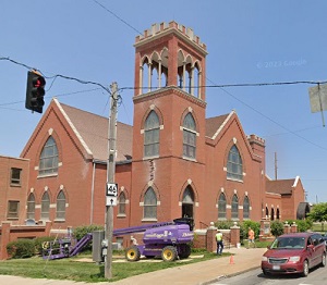
An image of Maryville

More city maps of Missouri:
- Map of Ferguson
Ferguson, Missouri is a suburb of St. Louis which became a scene of unrest and violent protests in... - Map of Independence
Independence, Missouri AKA "Queen City of the Trails" is a large eastern suburb of Kansas City wit... - Map of St. Charles
St. Charles, Missouri is a suburban city of St. Louis and the county seat of St. Charles County. ... - Map of Chesterfield
Chesterfield, Missouri is a fantastic city located in St. Louis County. Chesterfield is home to 50... - Map of University City
University City, Missouri is a western suburb of St. Louis. Today University City is home to 35 th... - Map of Kirkwood
Kirkwood, Missouri is a dynamic suburban city found in St. Louis County. The population of Kirkwoo... - Map of Hazelwood
Hazelwood is a city located in St. Louis County, about 15 miles northwest of downtown St. Louis. H... - Map of Ozark
Ozark, Missouri is a lovely city located in Christian County, about 15 miles northwest of Springfi... - Map of Concord
Concord, Missouri is a lovely suburban community located in St. Louis County, about 13 miles south... - Map of Spanish Lake
Spanish Lake is an unincorporated community and a CDP located in St. Louis County, Missouri. It st... - Map of Poplar Bluff
Poplar Bluff is a city located in Butler County, Missouri. It stands in the southeastern part of t... - Map of Grain Valley
Grain Valley, Missouri is a wonderful city located in Jackson County. It stands in the western par... - Map of Marshall
Marshall, Missouri is a lovely city located in Saline County. It stands in the central part of the... - Map of Dardenne Prairie
Dardenne Prairie is a city located in St. Charles County, Missouri. It is a suburb of the larger m... - Map of West Plains
West Plains, Missouri is a charming city found in Howell County, approximately 100 miles southeast... - Map of Kearney
Kearney, Missouri is an adorable city situated in Clay County. It stands in the western part of Mi...
Full list of Missouri maps
This online map of Maryville, Missouri is provided by Bing Maps. Please add a bookmark and share the page with your friends!
