The exact coordinates of Springfield Missouri for your GPS track:
Latitude 37.209999 North, Longitude 93.292267 West.
Please share the link with friends and neighbors:
Share on Facebook
Share on WhatsApp
Share on Telegram
Share on Facebook
Share on WhatsApp
Share on Telegram
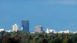
An image of Springfield
More city maps of Missouri:
- Map of Lee's Summit
Lee's Summit, Missouri, is a city located in Kansas City Metropolitan Area. The population of Lee'... - Map of St. Peters
St. Peters, Missouri is a suburban city of St. Louis, located in St. Charles County. St. Peters is... - Map of Jefferson City
Jefferson City is the capital city of Missouri. Today Jefferson City is populated by 43 thousand i... - Map of Cape Girardeau
Cape Girardeau, Missouri is a nice city located about 115 miles south of St. Louis. Founded back i... - Map of Liberty
Liberty, Missouri is a beautiful suburb of Kansas City and the county seat of Clay County. Today L... - Map of Maryland Heights
Maryland Heights, Missouri is a lovely city located in St. Louis County. It stands in the western ... - Map of Raymore
Raymore, Missouri is a shining city located in Cass County, about 20 miles south of Kansas City. T... - Map of Arnold
Arnold is a city in Jefferson County, Missouri. It is located in the southeastern part of the stat... - Map of Old Jamestown
Old Jamestown is an unincorporated community located in north St. Louis County, Missouri. It stand... - Map of Republic
Republic, Missouri is a city located in Greene County, approximately 15 miles southwest of downtow... - Map of Hannibal
Hannibal, Missouri is a wonderful city found in Marion County. It stands in the northeastern part ... - Map of Sikeston
Sikeston, Missouri is a pleasant city located in Scott County. It stands in the southeastern part... - Map of Jackson
Jackson is a city located in Cape Girardeau County, Missouri. It stands in the southeastern part o... - Map of Lebanon
Lebanon, Missouri is a shining city located in Laclede County. It stands in the southwestern part ... - Map of St. Ann
St. Ann is a city located in St. Louis County, Missouri. It stands in the eastern part of the stat... - Map of Branson
The town of Branson, Missouri, is a popular tourist destination located in the Ozark Mountains in ... - Map of Neosho
Neosho is a city located in Newton County, Missouri, about 20 miles south of Joplin. The city of N...
Distances from Springfield, Missouri:
- Distance between Springfield and Lee's Summit
- Distance between Springfield and St. Peters
- Distance between Springfield and Jefferson City
- Distance between Springfield and Cape Girardeau
- Distance between Springfield and Liberty
- Distance between Springfield and Maryland Heights
- Distance between Springfield and Raymore
- Distance between Springfield and Arnold
- Distance between Springfield and Old Jamestown
- Distance between Springfield and Republic
- Distance between Springfield and Hannibal
- Distance between Springfield and Sikeston
- Distance between Springfield and Jackson
- Distance between Springfield and Lebanon
- Distance between Springfield and St. Ann
- Distance between Springfield and Branson
- Distance between Springfield and Neosho
Full list of Missouri maps
This online map of Springfield, Missouri is provided by Bing Maps. Please add a bookmark and share the page with your friends!