The exact coordinates of Bridgewater New Jersey for your GPS track:
Latitude 40.593723 North, Longitude 74.606117 West.
Please share the link with friends and neighbors:
Share on Facebook
Share on WhatsApp
Share on Telegram
Share on Facebook
Share on WhatsApp
Share on Telegram
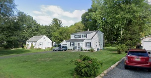
An image of Bridgewater
More city maps of New Jersey:
- Map of Lakewood
Lakewood Township is located in southern New Jersey and its population stands above 92 thousand pe... - Map of Passaic
Passaic is a city in New Jersey, located to the north of Newark and populated by 70 thousand peopl... - Map of Hamilton Township, Mercer County
Hamilton Township is located in Mercer County of New Jersey and has some 87 thousand inhabitants. ... - Map of Cherry Hill
Cherry Hill township is a large suburb of Philadelphia located in Camden County of New Jersey. It ... - Map of Middletown
Middletown, New Jersey is a remarkable coastal township located in Monmouth County, about 45 miles... - Map of Irvington
Irvington, New Jersey is a positive township located near Newark, in Essex County. Irvington is ho... - Map of New Brunswick
New Brunswick, New Jersey is a beautiful city and the county seat of Middlesex County. The total p... - Map of Bloomfield
Bloomfield, New Jersey is a large suburban township located in Essex County. Bloomfield is home to... - Map of East Brunswick
East Brunswick is a township located in Middlesex County, New Jersey. It's a suburban community lo... - Map of North Brunswick Township
North Brunswick is a township located in Middlesex County, New Jersey. North Brunswick was origina... - Map of Marlboro Township
Marlboro Township is located in Monmouth County, New Jersey. Marlboro was originally settled in th... - Map of Fort Lee
Fort Lee, New Jersey is a wonderful borough located in Bergen County. Fort Lee stands in northeast... - Map of Monroe Township, Gloucester County
Monroe Township (Gloucester County) is located in the southern part of New Jersey and is considere... - Map of City of Orange
The City of Orange is located in Essex County, New Jersey. The city covers an area of 2.2 square m... - Map of Livingston
Livingston is a township in Essex County, New Jersey. It is located approximately 20 miles west of... - Map of Rahway
Rahway, New Jersey is a lovely city situated in Union County. It stands approximately 20 miles sou... - Map of Stafford Township
Stafford Township is located in Ocean County, New Jersey, approximately 25 miles northeast of Atla...
Distances from Bridgewater, New Jersey:
- Distance between Bridgewater and Lakewood
- Distance between Bridgewater and Passaic
- Distance between Bridgewater and Hamilton Township, Mercer County
- Distance between Bridgewater and Cherry Hill
- Distance between Bridgewater and Middletown
- Distance between Bridgewater and Irvington
- Distance between Bridgewater and New Brunswick
- Distance between Bridgewater and Bloomfield
- Distance between Bridgewater and East Brunswick
- Distance between Bridgewater and North Brunswick Township
- Distance between Bridgewater and Marlboro Township
- Distance between Bridgewater and Fort Lee
- Distance between Bridgewater and Monroe Township, Gloucester County
- Distance between Bridgewater and City of Orange
- Distance between Bridgewater and Livingston
- Distance between Bridgewater and Rahway
- Distance between Bridgewater and Stafford Township
Full list of New Jersey maps
This online map of Bridgewater, New Jersey is provided by Bing Maps. Please add a bookmark and share the page with your friends!