Roosevelt County on the map of New Mexico 2025. Cities, roads, borders and directions in Roosevelt County of New Mexico.
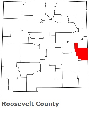
USA / New Mexico / Roosevelt CountyRoosevelt County is found in the eastern part of New Mexico. This famous county was named after Theodore Roosevelt (1858-1919), the twenty-sixth president of the United States. The population of Roosevelt County exceeds 19 thousand people. The county, organized in 1903, covers an area of 2,449 square miles. The county seat of Roosevelt County is Portales. This map shows the borders of Roosevelt County as well as neighboring counties, including major highways and natural objecsts as of 2025. Zoom in or out of the map using the plus/minus panel. Move the center of this map by dragging it. Also check out the satellite map of Roosevelt County.
The borders of Roosevelt County over the map of New Mexico
Explore some more counties of New Mexico:
- Valencia County
- Union County
- Torrance County
- Taos County
- Socorro County
- Sierra County
- Santa Fe County
- San Miguel County
- San Juan County
- Sandoval County
- Rio Arriba County
- Quay County
- Otero County
- Mora County
- McKinley County
- Luna County
- Los Alamos County
- Lincoln County
- Lea County
- Hidalgo County
Full list of New Mexico maps
This online map of Roosevelt County, New Mexico is provided by Bing Maps. Please add a bookmark and share the page with your friends!
© 2025 City maps and famous places