Eureka County on the map of Nevada 2026. Cities, roads, borders and directions in Eureka County of Nevada.
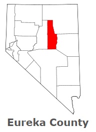
USA / Nevada / Eureka CountyEureka County occupies a part of central Nevada. This famous county was named after the Greek expression Eureka, meaning I have found it!. The population of Eureka County exceeds 2 thousand people. The county, organized in 1873, covers an area of 4,176 square miles. The county seat of Eureka County is Eureka. This map shows the borders of Eureka County as well as neighboring counties, including major highways and natural objecsts as of 2026. Zoom in or out of the map using the plus/minus panel. Move the center of this map by dragging it. Also check out the satellite map of Eureka County.
The borders of Eureka County over the map of Nevada
Explore some more counties of Nevada:
- White Pine County
- Washoe County
- Storey County
- Pershing County
- Nye County
- Mineral County
- Lyon County
- Lincoln County
- Lander County
- Humboldt County
- Esmeralda County
- Elko County
- Douglas County
- Churchill County
- Clark County
Full list of Nevada maps
This online map of Eureka County, Nevada is provided by Bing Maps. Please add a bookmark and share the page with your friends!
© 2026 City maps and famous places