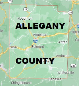
The borders of Allegany County over the map of New York
Explore some more counties of New York:
- Yates County
- Wyoming County
- Wayne County
- Washington County
- Warren County
- Ulster County
- Tompkins County
- Tioga County
- Sullivan County
- Steuben County
- Seneca County
- Schuyler County
- Schoharie County
- Schenectady County
- Saratoga County
- St. Lawrence County
- Rockland County
- Richmond County
- Rensselaer County
- Putnam County
Full list of New York maps
This online map of Allegany County, New York is provided by Bing Maps. Please add a bookmark and share the page with your friends!