The exact coordinates of Clay New York for your GPS track:
Latitude 43.186489 North, Longitude 76.190002 West.
Please share the link with friends and neighbors:
Share on Facebook
Share on WhatsApp
Share on Telegram
Share on Facebook
Share on WhatsApp
Share on Telegram
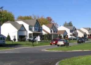
An image of Clay
More city maps of New York:
- Map of Syracuse
Syracuse is a city located in central New York state, in the United States. It is the fifth-most p... - Map of Mount Vernon
Mount Vernon is a city on the northern outskirts of NYC. The population of Mount Vernon is about 6... - Map of Niagara Falls
Niagara Falls, New York is a US city that stands on the American side of Niagara Waterfall. The po... - Map of Poughkeepsie
Poughkeepsie is a city located midway between New York City and Albany. This "Queen City of the Hu... - Map of Islip
Islip is a town in the central part of Long Island located about 40 miles east to Manhattan. The p... - Map of Ramapo
Ramapo, New York is a large town in the western part of in Rockland County with 148 thousand resid... - Map of Cheektowaga
Cheektowaga, New York is a town located to the east of Buffalo. The population of Cheektowaga exce... - Map of Orangetown
Orangetown NY is a suburb of New York City with 50 thousand residents. It is located in Rockland ... - Map of Mount Pleasant
The town of Mount Pleasant, New York is a northern suburb of New York City with 44 thousand reside... - Map of Webster
Webster, New York is a town located in Monroe County, home to 44 thousand residents. It was establ... - Map of Freeport
Freeport, New York is a remarkable city located in Nassau County. Freeport is home to 43 thousand ... - Map of Clifton Park
Clifton Park, New York is a well known town situated in Saratoga County. Clifton Park is populated... - Map of Riverhead
Riverhead, New York is a remarkable town located in Suffolk County. Riverhead is home to 35 thous... - Map of Manlius
Manlius, New York is an awesome town situated in Onondaga County. The population of Manlius exceed... - Map of North Tonawanda
North Tonawanda, New York is a wonderful city located in Niagara County. North Tonawanda is popula... - Map of East Fishkill
East Fishkill, New York is a cool town situated in Dutchess County, about 60 miles north to New Yo... - Map of Vestal
Vestal, New York is a famous city located in Broome County. The population of Vestal exceeds 28 th...
Full list of New York maps
This online map of Clay, New York is provided by Bing Maps. Please add a bookmark and share the page with your friends!