The exact coordinates of Fredonia New York for your GPS track:
Latitude 42.441078 North, Longitude 79.331924 West.
Share on Facebook
Share on WhatsApp
Share on Telegram
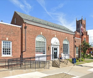
An image of Fredonia

More city maps of New York:
- Map of Buffalo
Buffalo is the second-largest city in the state of New York, located in western New York near the ... - Map of New York City
New York City is one of the largest cities on our planet and the biggest city of the US. It is the... - Map of Albany
Albany is a city in upstate New York, on the west bank of Hudson, with almost 100 thousand inhabit... - Map of White Plains
White Plains is a city on the northern outskirts of NYC with 57 thousand inhabitants. The city was... - Map of Hempstead town
Hempstead is a big town located on the western part of Long Island, in Nassau County, only a coupl... - Map of Babylon
The town of Babylon is located in Suffolk County, on the southern coast of Long Island. The total ... - Map of Greece
Greece, New York (established in 1822) is a large town located in the upstate area, close to the s... - Map of Tonawanda
Tonawanda is a large town on the western edge of the state of New York with 73 thousand residents.... - Map of Union town
Union (established in 1791) is a town in Upstate New York with 53 thousand residents. It is locate... - Map of Rye Town
Rye Town is a northern suburb of New York City with 46 thousand residents. It is located about 25 ... - Map of Penfield
Penfield, New York is a cool town, an eastern suburb of Rochester, situated in Monroe County. Penf... - Map of Bethlehem
Bethlehem, New York is an awesome town situated in Albany County. The population of Bethlehem exce... - Map of Salina
Salina, New York is a cool town situated in Onondaga County. Salina is home to 32 thousand America... - Map of Cicero
Cicero, New York is a remarkable town located in Onondaga County. Cicero is home to 31 thousand Am... - Map of Orchard Park
Orchard Park, New York is an awesome suburban town of Buffalo, situated in Erie County. The popula... - Map of Port Chester
Port Chester, New York is an coastal village situated in Westchester County. The population of Por... - Map of Saratoga Springs
Saratoga Springs, New York is an excellent city located in upstate New York, in Saratoga County. T...
Distances from Fredonia, New York:
- Distance between Fredonia and Buffalo
- Distance between Fredonia and New York City
- Distance between Fredonia and Albany
- Distance between Fredonia and White Plains
- Distance between Fredonia and Hempstead town
- Distance between Fredonia and Babylon
- Distance between Fredonia and Greece
- Distance between Fredonia and Tonawanda
- Distance between Fredonia and Union town
- Distance between Fredonia and Rye Town
- Distance between Fredonia and Penfield
- Distance between Fredonia and Bethlehem
- Distance between Fredonia and Salina
- Distance between Fredonia and Cicero
- Distance between Fredonia and Orchard Park
- Distance between Fredonia and Port Chester
- Distance between Fredonia and Saratoga Springs
Full list of New York maps
This online map of Fredonia, New York is provided by Bing Maps. Please add a bookmark and share the page with your friends!
