Livingston County on the map of New York 2026. Cities, roads, borders and directions in Livingston County of New York.
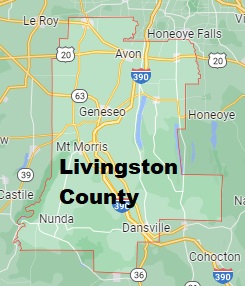
USA / New York / Livingston CountyLivingston County is located in the western part of New York the state. This wonderful county was brought to the map back in 1821. The county seat of Livingston County is Geneseo. The total population of the county exceeds 62 thousand residents. The county's area is 640 square miles. This map shows the borders of Livingston County as well as neighboring counties, including major highways and natural objecsts as of 2026. Zoom in or out of the map using the plus/minus panel. Move the center of this map by dragging it. Also check out the satellite map of Livingston County.
The borders of Livingston County over the map of New York
Explore some more counties of New York:
- Yates County
- Wyoming County
- Wayne County
- Washington County
- Warren County
- Ulster County
- Tompkins County
- Tioga County
- Sullivan County
- Steuben County
- Seneca County
- Schuyler County
- Schoharie County
- Schenectady County
- Saratoga County
- St. Lawrence County
- Rockland County
- Richmond County
- Rensselaer County
- Putnam County
Full list of New York maps
This online map of Livingston County, New York is provided by Bing Maps. Please add a bookmark and share the page with your friends!
© 2026 City maps and famous places