The exact coordinates of Rochester New York for your GPS track:
Latitude 43.1577 North, Longitude 77.609291 West.
Share on Facebook
Share on WhatsApp
Share on Telegram
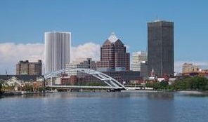
An image of Rochester

More city maps of New York:
- Map of Utica
Utica, incorporated 1832, is a city in upstate New York with 62 thousand inhabitants. It is locate... - Map of Rome
Rome, New York, incorporated 1870, is a small city in the central part of the state with some 33 t... - Map of North Hempstead
The town of North Hempstead is a large eastern suburb of New York City located in the northern par... - Map of Smithtown
Smithtown, New York is a town on the northern coast of Long Island with 116 thousand inhabitants. ... - Map of Colonie
Colonie, New York is a large suburb of Albany with 85 thousand residents. This town was incorporat... - Map of Southampton
Southampton, New York is a large town located on the eastern tip of Long Island, populated by 70 t... - Map of Hempstead village
Hempstead village is a settlement on Long Island, a part of the larger Hempstead town. The total p... - Map of Perinton
Perinton, New York (established 1812) is a town in upstate New York with 46 thousand residents. It... - Map of Lancaster
Lancaster town, New York, is a suburb of Buffalo with 43 thousand residents. It is a part of Erie ... - Map of Valley Stream
Valley Stream, New York is a wonderful village located in Nassau County. Valley Stream is populate... - Map of Guilderland
Guilderland, New York is a remarkable town located in Albany County. Guilderland is home to 36 tho... - Map of Clarence
Clarence, New York is a wonderful town, an eastern suburb of Buffalo, located in Erie County. Clar... - Map of Newburgh
Newburgh, New York is a cool city situated on the eastern bank of Hudson River, in Orange County. ... - Map of Mamaroneck
Mamaroneck, New York is a remarkable town located in Westchester County, a northern suburb of New ... - Map of Glenville
Glenville, New York (incorporated in 1820) is a remarkable town located in Schenectady County. Gle... - Map of Harrison
Harrison, New York is an awesome town situated on the northern outskirts of New York City, in West... - Map of Lindenhurst
Lindenhurst, New York is a famous Long Island village located in Suffolk County, about 35 miles ea...
Distances from Rochester, New York:
- Distance between Rochester and Utica
- Distance between Rochester and Rome
- Distance between Rochester and North Hempstead
- Distance between Rochester and Smithtown
- Distance between Rochester and Colonie
- Distance between Rochester and Southampton
- Distance between Rochester and Hempstead village
- Distance between Rochester and Perinton
- Distance between Rochester and Lancaster
- Distance between Rochester and Valley Stream
- Distance between Rochester and Guilderland
- Distance between Rochester and Clarence
- Distance between Rochester and Newburgh
- Distance between Rochester and Mamaroneck
- Distance between Rochester and Glenville
- Distance between Rochester and Harrison
- Distance between Rochester and Lindenhurst
Full list of New York maps
This online map of Rochester, New York is provided by Bing Maps. Please add a bookmark and share the page with your friends!
