The exact coordinates of Northbrook Ohio for your GPS track:
Latitude 39.242573 North, Longitude 84.577728 West.
Please share the link with friends and neighbors:
Share on Facebook
Share on WhatsApp
Share on Telegram
Share on Facebook
Share on WhatsApp
Share on Telegram
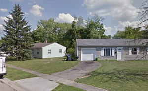
An image of Northbrook
More city maps of Ohio:
- Map of Columbus
Columbus is Ohio's largest city and capital. It is also known for being a major research and educa... - Map of Hamilton
Hamilton, Ohio is a city located about 18 miles north to Cincinnati. It is the county seat of the ... - Map of Elyria
Elyria, Ohio is the county seat of Lorain County. The population of Elyria exceeds 53 thousand peo... - Map of Dublin
Dublin, Ohio is a handsome city located on the northwestern edge of Coluumbus. Dublin is home to 4... - Map of Strongsville
Strongsville, Ohio is a dynamic suburban city of Cleveland, situated in Cuyahoga County. Today Str... - Map of Grove City
Grove City, Ohio is found in Franklin County, about 10 miles southwest to downtown Columbus. The p... - Map of Westerville
Westerville, Ohio is a suburban city of Columbus. Today Westerville is populated by 39 thousand in... - Map of Marion
Marion, Ohio is the county seat of Marion County. Marion is home to 36 thousand residents. ... - Map of North Olmsted
North Olmsted, Ohio is a charming suburban city of Cleveland, standing in Cuyahoga County. The pop... - Map of Green
Green, Ohio (founded in 1809) is a charming city located near Akron, in Summit County. The populat... - Map of Avon Lake
Avon Lake, Ohio is a lakeside city found in Lorain County. The population of Avon Lake exceeds 26 ... - Map of Sandusky
Sandusky, Ohio is a dynamic lakeside city found in Erie County. The population of Sandusky exceeds... - Map of Wadsworth
Wadsworth, Ohio is a shining city located in Medina County. Founded in 1814, these days Wadsworth ... - Map of Hudson
Hudson, Ohio is a shining city located 30 miles southeast of Cleveland, in Summit County. Hudson i... - Map of South Euclid
South Euclid, Ohio is a shining city located east of Cleveland, in Cuyahoga County. South Euclid i... - Map of Piqua
Piqua, Ohio is a hilarious city situated in Miami County, about 28 miles north of Dayton. Today Pi... - Map of Ashland
Ashland, Ohio is a charming city that serves as the county seat of Ashland County. It stands in th...
Distances from Northbrook, Ohio:
- Distance between Northbrook and Columbus
- Distance between Northbrook and Hamilton
- Distance between Northbrook and Elyria
- Distance between Northbrook and Dublin
- Distance between Northbrook and Strongsville
- Distance between Northbrook and Grove City
- Distance between Northbrook and Westerville
- Distance between Northbrook and Marion
- Distance between Northbrook and North Olmsted
- Distance between Northbrook and Green
- Distance between Northbrook and Avon Lake
- Distance between Northbrook and Sandusky
- Distance between Northbrook and Wadsworth
- Distance between Northbrook and Hudson
- Distance between Northbrook and South Euclid
- Distance between Northbrook and Piqua
- Distance between Northbrook and Ashland
Full list of Ohio maps
This online map of Northbrook, Ohio is provided by Bing Maps. Please add a bookmark and share the page with your friends!