The exact coordinates of Parma Heights Ohio for your GPS track:
Latitude 41.389854 North, Longitude 81.762444 West.
Please share the link with friends and neighbors:
Share on Facebook
Share on WhatsApp
Share on Telegram
Share on Facebook
Share on WhatsApp
Share on Telegram
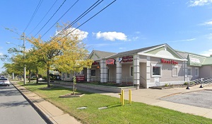
An image of Parma Heights
More city maps of Ohio:
- Map of Toledo
Toledo is a city in northwest Ohio, located along the western end of Lake Erie. It is the fourth m... - Map of Lorain
Lorain, Ohio is a city with 65 thousand residents located about 29 miles west to Cleveland. It sta... - Map of Kettering
Kettering, Ohio is a nice city located near Dayton, in Montgomery County. Kettering is home to 57 ... - Map of Lakewood
Lakewood, Ohio is a beautiful coastal city situated near Cleveland, in Cuyahoga County. Today Lake... - Map of Beavercreek
Beavercreek, Ohio is a cool suburban city of Dayton, found in Greene County. The population of Bea... - Map of Delaware
Delaware, Ohio is a pretty city located about 28 miles north to Columbus, in Delaware County. Dela... - Map of Warren
Warren, Ohio is the county seat of Trumbull County. The population of Warren exceeds 39 thousand p... - Map of Lima
Lima, Ohio is a wonderful city and the county seat of Allen County. Founded in 1831, today Lima is... - Map of Massillon
Massillon, Ohio is an attractive city located in Stark County. Founded in 1868, Massillon today is... - Map of Kent
Kent, Ohio is a lovely city located in Portage County. Incorporated back in 1867, today Kent is ho... - Map of Medina
Medina, Ohio is a shining city and the seat of Medina County. Founded in 1818, today Medina is hom... - Map of Barberton
Barberton, Ohio is a shining city located near Akron, in Summit County. Founded in 1891, Barberton... - Map of Athens
Athens, Ohio is the seat of Athens County, located 73 miles southeast of Columbus. Incorporated in... - Map of Maple Heights
Maple Heights, Ohio is a charming city found 10 miles southeast of Cleveland, in Cuyahoga County. ... - Map of Alliance
Alliance, Ohio is a charming city found in Stark County. The population of Alliance exceeds 22 tho... - Map of Broadview Heights
Broadview Heights, Ohio is a lovely city located in Cuyahoga County. It is a suburb of Cleveland a... - Map of Norwood
Norwood is a city located in Hamilton County, Ohio. It stands in the southwestern part of the stat...
Distances from Parma Heights, Ohio:
- Distance between Parma Heights and Toledo
- Distance between Parma Heights and Lorain
- Distance between Parma Heights and Kettering
- Distance between Parma Heights and Lakewood
- Distance between Parma Heights and Beavercreek
- Distance between Parma Heights and Delaware
- Distance between Parma Heights and Warren
- Distance between Parma Heights and Lima
- Distance between Parma Heights and Massillon
- Distance between Parma Heights and Kent
- Distance between Parma Heights and Medina
- Distance between Parma Heights and Barberton
- Distance between Parma Heights and Athens
- Distance between Parma Heights and Maple Heights
- Distance between Parma Heights and Alliance
- Distance between Parma Heights and Broadview Heights
- Distance between Parma Heights and Norwood
Full list of Ohio maps
This online map of Parma Heights, Ohio is provided by Bing Maps. Please add a bookmark and share the page with your friends!