Logan County on the map of Oklahoma 2026. Cities, roads, borders and directions in Logan County of Oklahoma.
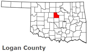
USA / Oklahoma / Logan CountyLogan County is situated in the central part of Oklahoma. This prominent county is named after John A. Logan, American Civil War general. The area of Logan County is about 745 square miles. This county, set up in 1891, is populated today by 51 thousand residents. Guthrie is the county seat of Logan County. This map shows the borders of Logan County as well as neighboring counties, including major highways and natural objecsts as of 2026. Zoom in or out of the map using the plus/minus panel. Move the center of this map by dragging it. Also check out the satellite map of Logan County.
The borders of Logan County over the map of Oklahoma
Explore some more counties of Oklahoma:
- Woodward County
- Woods County
- Washita County
- Washington County
- Wagoner County
- Tulsa County
- Tillman County
- Texas County
- Stephens County
- Sequoyah County
- Seminole County
- Rogers County
- Roger Mills County
- Pushmataha County
- Pottawatomie County
- Pontotoc County
- Pittsburg County
- Payne County
- Pawnee County
- Ottawa County
Full list of Oklahoma maps
This online map of Logan County, Oklahoma is provided by Bing Maps. Please add a bookmark and share the page with your friends!
© 2026 City maps and famous places