The exact coordinates of Astoria Oregon for your GPS track:
Latitude 46.188499 North, Longitude 123.831757 West.
Please share the link with friends and neighbors:
Share on Facebook
Share on WhatsApp
Share on Telegram
Share on Facebook
Share on WhatsApp
Share on Telegram
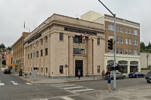
An image of Astoria
More city maps of Oregon:
- Map of Eugene
Eugene, Oregon is a city located south to Portland on Interstate 5 highway. The population of Euge... - Map of Aloha
Aloha, Oregon is a dynamic suburban city of Portland, located in Washington County. Today Aloha is... - Map of Redmond
Redmond, Oregon is a nice city situated in Deschutes County. Today Redmond is populated by 36 thou... - Map of Happy Valley
Happy Valley, Oregon is a charming city standing southeast of Portland in Clackamas County. The po... - Map of Ashland
Ashland, Oregon is a dynamic city located in Jackson County. Settled in 1852, today Ashland is hom... - Map of Lebanon
Lebanon, Oregon is a charming city found in Linn County. It stands in the Willamette Valley region... - Map of Four Corners
Four Corners, Oregon is a beautiful suburban CDP located in Marion County, about 3 miles east of S... - Map of La Grande
La Grande is a city located in Union County, Oregon. It stands in the northeastern part of the sta... - Map of Oak Hills
Oak Hills, Oregon is an adorable unincorporated community and a census-designated place located in... - Map of Prineville
Prineville, Oregon is a wonderful city situated in Crook County. It stands in Central Oregon and i...
Distances from Astoria, Oregon:
- Distance between Astoria and Eugene
- Distance between Astoria and Aloha
- Distance between Astoria and Redmond
- Distance between Astoria and Happy Valley
- Distance between Astoria and Ashland
- Distance between Astoria and Lebanon
- Distance between Astoria and Four Corners
- Distance between Astoria and La Grande
- Distance between Astoria and Oak Hills
- Distance between Astoria and Prineville
Full list of Oregon maps
This online map of Astoria, Oregon is provided by Bing Maps. Please add a bookmark and share the page with your friends!