The exact coordinates of Oregon City Oregon for your GPS track:
Latitude 45.355614 North, Longitude 122.605804 West.
Please share the link with friends and neighbors:
Share on Facebook
Share on WhatsApp
Share on Telegram
Share on Facebook
Share on WhatsApp
Share on Telegram
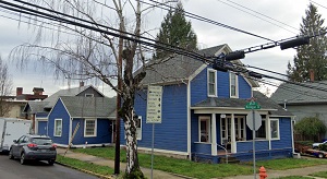
An image of Oregon City
More city maps of Oregon:
- Map of Salem
Salem is the second largest city in Oregon, after Portland. Its population is estimated to exceed ... - Map of Gresham
Gresham, Oregon (incorporated 1905) is a large eastern suburb of Portland with 110 thousand inhabi... - Map of Tigard
Tigard, Oregon is a cool suburban city of Portland, situated in Washington County. Today Tigard is... - Map of Woodburn
Woodburn, Oregon is a lovely city located in Marion County. Incorporated back in 1889, today Woodb... - Map of Klamath Falls
The city of Klamath Falls, Oregon is the county seat of Klamath County. Incorporated in 1905, toda... - Map of Central Point
Central Point, Oregon is a lovely city located in Jackson County. It stands in the Rogue Valley re... - Map of Dallas
Dallas, Oregon is a shining city situated in Polk County, in the Willamette Valley region of weste... - Map of St. Helens
St. Helens, Oregon is a shining city that serves as the county seat of Columbia County. It stands ... - Map of Gladstone
Gladstone is a city located in Clackamas County, Oregon. It stands just south of Portland, making ... - Map of Monmouth
Monmouth is a city located in Polk County, Oregon. It's nested in the Willamette Valley and is kno... - Map of North Bend
North Bend, Oregon is a pleasant city found in Coos County. It stands on the southern Oregon coast... - Map of Fairview
Fairview, Oregon is a shining city located in Multnomah County. It's part of the Portland metropol...
Full list of Oregon maps
This online map of Oregon City, Oregon is provided by Bing Maps. Please add a bookmark and share the page with your friends!