The exact coordinates of White City Oregon for your GPS track:
Latitude 42.432407 North, Longitude 122.835037 West.
Please share the link with friends and neighbors:
Share on Facebook
Share on WhatsApp
Share on Telegram
Share on Facebook
Share on WhatsApp
Share on Telegram
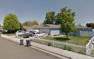
An image of White City
More city maps of Oregon:
- Map of Medford
Medford is the 8-th largest city in Oregon. Its population counts approximately 85 thousand reside... - Map of Bend
Bend is a city in central Oregon with almost 100 thousand residents. Incorporated in 1905, it is t... - Map of Lake Oswego
Lake Oswego, Oregon is a growing city located about 8 miles south to Portland. The population of L... - Map of McMinnville
McMinnville, Oregon is the county seat of Yamhill County. McMinnville is home to 35 thousand resid... - Map of West Linn
West Linn, Oregon is a shining city located in Clackamas County. Incorporated in 1913, West Linn i... - Map of Newberg
Newberg, Oregon is a hilarious city situated southwest of Portland, in Yamhill County. Incorporate... - Map of Milwaukie
Milwaukie, Oregon is a wonderful city standing south of Portland, mainly in Clackamas County. The ... - Map of Altamont
Altamont, Oregon is a beautiful CDP located in Klamath County, not far from the border with Califo... - Map of Canby
Canby, Oregon is a city in the northern part of Clackamas County, approximately 20 miles south of ... - Map of Troutdale
Troutdale, Oregon is a wonderful city in Multnomah County. Troutdale stands at the confluence of t... - Map of Oatfield
Oatfield, Oregon is a wonderful CDP located in Clackamas County. Oatfield is known for its suburba... - Map of Santa Clara
Santa Clara, Oregon is a pleasant neighborhood in the northern part of Eugene. It is situated in L... - Map of Cottage Grove
Cottage Grove, Oregon is a lovely city located in Lane County. It stands in the southern Willamett...
Full list of Oregon maps
This online map of White City, Oregon is provided by Bing Maps. Please add a bookmark and share the page with your friends!