The exact coordinates of McCandless Pennsylvania for your GPS track:
Latitude 40.566669 North, Longitude 80.01667 West.
Please share the link with friends and neighbors:
Share on Facebook
Share on WhatsApp
Share on Telegram
Share on Facebook
Share on WhatsApp
Share on Telegram
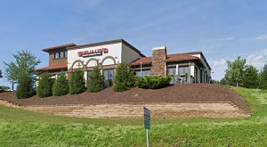
An image of McCandless
More city maps of Pennsylvania:
- Map of Reading
Reading is the fifth largest city in Pennsylvania with over 88 thousand inhabitants. Historically ... - Map of Harrisburg
Harrisburg, incorporated 1791, is the capital city of Pennsylvania. It also serves as the county s... - Map of Bristol Township
Bristol Township, Pennsylvania is a beautiful township located in Bucks County. Formed back in 169... - Map of Abington
Abington, Pennsylvania is a beautiful township located in Montgomery County. Abington is home to 5... - Map of Northampton Township
Northampton Township, Pennsylvania is located about 26 miles northeast to Philadelphia, in Bucks C... - Map of Falls Township
Falls Township, Pennsylvania is located near Trenton, in Bucks County. Falls Township is home to 3... - Map of Radnor
Radnor, Pennsylvania is a cool township situated about 17 miles northwest to Philadelphia. Radnor ... - Map of Chester
Chester, Pennsylvania is a lovely suburban city of Philadelphia, situated in Delaware County. The ... - Map of Swatara Township
Swatara Township, Pennsylvania is located in Dauphin County. Incorporated in 1799, today Swatara T... - Map of Upper Dublin
Upper Dublin, Pennsylvania is a charming township in Montgomery County. The population of Upper Du... - Map of Horsham
Horsham, Pennsylvania is a home rule municipality located in Montgomery County. Established in 171... - Map of Warrington Township
Warrington Township, Pennsylvania is the gateway to historic Bucks County. Founded in October 1734... - Map of Upper Providence
Upper Providence, Pennsylvania is a shining township located in Montgomery County, 30 miles northw... - Map of Peters
Peters, Pennsylvania is a nice township located in Washington County. Established in 1781, today P... - Map of Manor Township
Manor, Pennsylvania is a shining township located in Lancaster County. Incorporated in 1730, Manor... - Map of East Pennsboro
East Pennsboro, Pennsylvania is a township located in Cumberland County. Today East Pennsboro is h... - Map of Springfield Township
Springfield Township, Pennsylvania is located 12 miles north of Philadelphia, in Montgomery County...
Distances from McCandless, Pennsylvania:
- Distance between McCandless and Reading
- Distance between McCandless and Harrisburg
- Distance between McCandless and Bristol Township
- Distance between McCandless and Abington
- Distance between McCandless and Northampton Township
- Distance between McCandless and Falls Township
- Distance between McCandless and Radnor
- Distance between McCandless and Chester
- Distance between McCandless and Swatara Township
- Distance between McCandless and Upper Dublin
- Distance between McCandless and Horsham
- Distance between McCandless and Warrington Township
- Distance between McCandless and Upper Providence
- Distance between McCandless and Peters
- Distance between McCandless and Manor Township
- Distance between McCandless and East Pennsboro
- Distance between McCandless and Springfield Township
Full list of Pennsylvania maps
This online map of McCandless, Pennsylvania is provided by Bing Maps. Please add a bookmark and share the page with your friends!