The exact coordinates of Norristown Pennsylvania for your GPS track:
Latitude 40.120911 North, Longitude 75.34066 West.
Please share the link with friends and neighbors:
Share on Facebook
Share on WhatsApp
Share on Telegram
Share on Facebook
Share on WhatsApp
Share on Telegram
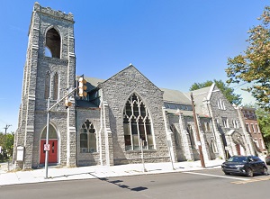
An image of Norristown
More city maps of Pennsylvania:
- Map of Pittsburgh
Pittsburgh is a city located in the western part of the state of Pennsylvania, in the United State... - Map of Philadelphia
Philadelphia, Pennsylvania is the largest city in the state and the county seat of Philadelphia Co... - Map of Erie
Erie is a city in northwestern Pennsylvania, on the coast of Lake Erie. The population of the city... - Map of Punxsutawney
Punxsutawney is a famous borough in Jefferson County, Pennsylvania, located about 80 miles northwe... - Map of Haverford
Haverford, Pennsylvania is an unincorporated western suburb of Philadeplphia. Haverford is populat... - Map of Hempfield Township
Hempfield Township, Pennsylvania is a beautiful suburb of Pittsburgh located in Westmoreland Count... - Map of Mount Lebanon
Mount Lebanon, Pennsylvania is a nice suburb of Pittsburgh. Mount Lebanon is populated these days ... - Map of Bethel Park
Bethel Park, Pennsylvania is a beautiful suburban home rule borough of Pittsburgh, located in Alle... - Map of Lower Macungie
Lower Macungie, Pennsylvania is a beautiful township located near Allentown, in Lehigh County. Low... - Map of Hazleton
Hazleton, Pennsylvania is a shining city located in Luzerne County, about 100 miles northwest of P... - Map of Easton
Easton, Pennsylvania is the county seat of Northampton County. The population of Easton exceeds 28... - Map of Moon
Moon, Pennsylvania is a lovely township located in Allegheny County. Incorporated back in 1788, Mo... - Map of Lebanon
Lebanon, Pennsylvania is a shining city and the seat of Lebanon County. Incorporate in 1821, Leban... - Map of Bethlehem Township
Bethlehem Township, Pennsylvania is located near Allentown, in Northampton County. Bethlehem Towns... - Map of Derry Township
Derry Township, Pennsylvania is located east of Harrisburg, in Dauphin County. Incorporated in 172... - Map of West Goshen
West Goshen, Pennsylvania is a township located in Chester County. Founded back in 1681, West Gosh... - Map of Muhlenberg
Muhlenberg, Pennsylvania is a township located near Reading, in Berks County. Muhlenberg is home t...
Distances from Norristown, Pennsylvania:
- Distance between Norristown and Pittsburgh
- Distance between Norristown and Philadelphia
- Distance between Norristown and Erie
- Distance between Norristown and Punxsutawney
- Distance between Norristown and Haverford
- Distance between Norristown and Hempfield Township
- Distance between Norristown and Mount Lebanon
- Distance between Norristown and Bethel Park
- Distance between Norristown and Lower Macungie
- Distance between Norristown and Hazleton
- Distance between Norristown and Easton
- Distance between Norristown and Moon
- Distance between Norristown and Lebanon
- Distance between Norristown and Bethlehem Township
- Distance between Norristown and Derry Township
- Distance between Norristown and West Goshen
- Distance between Norristown and Muhlenberg
Full list of Pennsylvania maps
This online map of Norristown, Pennsylvania is provided by Bing Maps. Please add a bookmark and share the page with your friends!