Susquehanna County on the map of Pennsylvania 2025. Cities, roads, borders and directions in Susquehanna County of Pennsylvania.
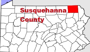
USA / Pennsylvania / Susquehanna CountySusquehanna County is situated in the northeastern corner of Pennsylvania. The county is named after Susquehanna River, from an Algonquin word for Muddy Current. The area of Susquehanna County is about 832 square miles. The county was set up in 1810 and it is populated today by 38 thousand residents. Montrose is the county seat of Susquehanna County. This map shows the borders of Susquehanna County as well as neighboring counties, including major highways and natural objecsts as of 2025. Zoom in or out of the map using the plus/minus panel. Move the center of this map by dragging it. Also check out the satellite map of Susquehanna County.
The borders of Susquehanna County over the map of Pennsylvania
Explore some more counties of Pennsylvania:
- York County
- Wyoming County
- Westmoreland County
- Wayne County
- Washington County
- Warren County
- Venango County
- Union County
- Tioga County
- Sullivan County
- Somerset County
- Snyder County
- Schuylkill County
- Potter County
- Pike County
- Perry County
- Northumberland County
- Northampton County
- Montour County
- Monroe County
Full list of Pennsylvania maps
This online map of Susquehanna County, Pennsylvania is provided by Bing Maps. Please add a bookmark and share the page with your friends!
© 2025 City maps and famous places