The exact coordinates of Fountain Inn South Carolina for your GPS track:
Latitude 34.692303 North, Longitude 82.195671 West.
Please share the link with friends and neighbors:
Share on Facebook
Share on WhatsApp
Share on Telegram
Share on Facebook
Share on WhatsApp
Share on Telegram
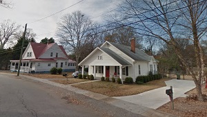
An image of Fountain Inn
More city maps of South Carolina:
- Map of Columbia
Columbia is the capital and second largest city of the U.S. state of South Carolina.... - Map of Goose Creek
Goose Creek, South Carolina is a beautiful city situated near Charleston in Berkeley County. The t... - Map of Hilton Head Island
Hilton Head Island, South Carolina is a positive resort town located on an island in Beaufort Coun... - Map of Fort Mill
Fort Mill, South Carolina is a wonderful city situated in Lancaster County. It is actually a subur... - Map of Lexington
Lexington, South Carolina is a remarkable town and the county seat of Lexington County. The total ... - Map of Taylors
Taylors, South Carolina is a CDP located in Greenville County. Today Taylors is home to 23 thousan... - Map of West Columbia
West Columbia, South Carolina is a wonderful city situated in Lexington County. It stands across t... - Map of Dentsville
Dentsville is a community located in Richland County, South Carolina. It is an unincorporated area... - Map of Ladson
Ladson is a small town located in Berkeley, Charleston, and Dorchester counties in the state of So... - Map of Orangeburg
Orangeburg, South Carolina is an adorable city that serves as the county seat of Orangeburg County... - Map of Irmo
Irmo, South Carolina is a charming town in Lexington and Richland counties. It is situated just no...
Full list of South Carolina maps
This online map of Fountain Inn, South Carolina is provided by Bing Maps. Please add a bookmark and share the page with your friends!