Roberts County on the map of South Dakota 2026. Cities, roads, borders and directions in Roberts County of South Dakota.
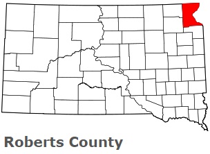
USA / South Dakota / Roberts CountyRoberts County is found in the northeastern corner of South Dakota. This amazing county is named after S.G. Roberts, territorial legislator. The population of Roberts County exceeds 10 thousand people. The county, organized in 1883, spans an area of 1101 square miles. The county seat of Roberts County is Sisseton. This map shows the borders of Roberts County as well as neighboring counties, including major highways and natural objecsts as of 2026. Zoom in or out of the map using the plus/minus panel. Move the center of this map by dragging it. Also check out the satellite map of Roberts County.
The borders of Roberts County over the map of South Dakota
Explore some more counties of South Dakota:
- Ziebach County
- Yankton County
- Walworth County
- Union County
- Turner County
- Tripp County
- Todd County
- Sully County
- Stanley County
- Spink County
- Sanborn County
- Potter County
- Perkins County
- Pennington County
- Oglala Lakota County
- Moody County
- Minnehaha County
- Miner County
- Mellette County
- Meade County
Full list of South Dakota maps
This online map of Roberts County, South Dakota is provided by Bing Maps. Please add a bookmark and share the page with your friends!
© 2026 City maps and famous places