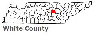
White County on the map of Tennessee 2025. Cities, roads, borders and directions in White County of Tennessee.
USA / Tennessee / White CountyWhite County is located in the central region of Tennessee. This famous county is named after John White, Revolutionary War soldier and the first European-American settler in the county. The county seat of White County is Sparta. Formed in 1806, today White County is home to 28 thousand residents. This map shows the borders of White County as well as neighboring counties, including major highways and natural objecsts as of 2025. Zoom in or out of the map using the plus/minus panel. Move the center of this map by dragging it. Also check out the satellite map of White County.
The borders of White County over the map of Tennessee
Explore some more counties of Tennessee:
- Wilson County
- Williamson County
- Weakley County
- Wayne County
- Washington County
- Warren County
- Van Buren County
- Union County
- Unicoi County
- Trousdale County
- Tipton County
- Sumner County
- Sullivan County
- Stewart County
- Smith County
- Sevier County
- Sequatchie County
- Scott County
- Rutherford County
- Robertson County
Full list of Tennessee maps
This online map of White County, Tennessee is provided by Bing Maps. Please add a bookmark and share the page with your friends!
© 2025 City maps and famous places