The exact coordinates of Bastrop Texas for your GPS track:
Latitude 30.110603 North, Longitude 97.315086 West.
Please share the link with friends and neighbors:
Share on Facebook
Share on WhatsApp
Share on Telegram
Share on Facebook
Share on WhatsApp
Share on Telegram
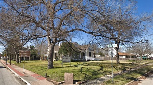
An image of Bastrop
More city maps of Texas:
- Map of Plano
Plano is a city in the U.S. state of Texas, located in the Dallas-Fort Worth metropolitan area. It... - Map of Fort Worth
Fort Worth, Texas is the fifth largest city in the state and the county seat of Tarrant County. ... - Map of Pasadena
Pasadena is a city in Texas, a big suburb of Houston with 150 thousand inhabitants.... - Map of Frisco
Frisco, Texas is a city located in the northern part of Dallas / Fort Worth metroplex. Its estimat... - Map of Denton
Denton, Texas is a city located on the northern edge of Dallas–Fort Worth metropolitan area. The... - Map of Abilene
Abilene (incorporated 1881) is a city in central Texas, located near the famous Dyess Air Force Ba... - Map of Round Rock
Round Rock, Texas is a large northern suburb of Austin with population of 112 thousand. Round Rock... - Map of College Station
College Station, commonly known as C-Stat, is a city located in Central Texas, around the campus o... - Map of Bryan
Bryan, Texas is a city located in Brazos County, bordering College Station. The population of Brya... - Map of Flower Mound
Flower Mound is a town in North Texas with 77 thousand residents. It is located about 20 miles nor... - Map of North Richland Hills
North Richland Hills, Texas is a large and wealthy suburb of Fort Worth with 70 thousand residents... - Map of Colleyville
Colleyville, Texas is a city located inside the Dallas-Fort Worth metroplex. The population of Col... - Map of Spring
Spring, Texas is a nice CDP situated in Harris County, about 24 miles north to downtown Houston. S... - Map of Texas City
Texas City, Texas is an excellent coastal city located near Houston, in Galveston County. The tota... - Map of Burleson
Burleson, Texas is a lovely city situated about 16 miles south to Fort Worth, in Johnson County. T... - Map of Cedar Hill
Cedar Hill, Texas is a fantastic city located about 16 miles southwest to Dallas. Cedar Hill is ho... - Map of Sherman
The city of Sherman, Texas is the county seat of Grayson County. Sherman is populated these days b...
Full list of Texas maps
This online map of Bastrop, Texas is provided by Bing Maps. Please add a bookmark and share the page with your friends!