The exact coordinates of Highland Utah for your GPS track:
Latitude 40.42728 North, Longitude 111.796059 West.
Please share the link with friends and neighbors:
Share on Facebook
Share on WhatsApp
Share on Telegram
Share on Facebook
Share on WhatsApp
Share on Telegram
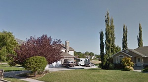
An image of Highland
More city maps of Utah:
- Map of Sandy
Sandy, Utah is a large suburb of Salt Lake City with more than 80 thousand inhabitants.... - Map of Millcreek
Millcreek, Utah is a large southern suburb of Salt Lake City with 63 thousand residents. It was in... - Map of Draper
Draper, Utah is a lovely city found 20 miles south of Salt Lake City. Draper was settled in 1849 a... - Map of Spanish Fork
Spanish Fork, Utah is a fantastic city located near Provo in Utah County. Incorporated on January ... - Map of Kearns
Kearns, Utah is a wonderful suburban township situated 12 miles southwest to Salt Lake City. Incor... - Map of Clearfield
Clearfield, Utah (incorporated in 1922) is a charming city standing 29 miles north of Salt Lake Ci... - Map of Clinton
Clinton, Utah is a lovely city located in Davis County. It is part of the Ogden-Clearfield Metropo... - Map of Heber City
Heber City is located in Wasatch County, Utah. It stands in the central part of the state, in the ... - Map of Woods Cross
Woods Cross, Utah is a lovely city located in Davis County. It stands just north of Salt Lake City... - Map of North Logan
North Logan, Utah is a shining city found in Cache County. It stands in the northern part of the s...
Full list of Utah maps
This online map of Highland, Utah is provided by Bing Maps. Please add a bookmark and share the page with your friends!