The exact coordinates of South Ogden Utah for your GPS track:
Latitude 41.178894 North, Longitude 111.962891 West.
Please share the link with friends and neighbors:
Share on Facebook
Share on WhatsApp
Share on Telegram
Share on Facebook
Share on WhatsApp
Share on Telegram
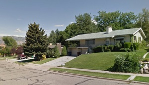
An image of South Ogden
More city maps of Utah:
- Map of Provo
Provo is one of the largest cities in Utah with about 116 thousand inhabitants. It is located some... - Map of South Jordan
South Jordan, Utah is a large southern suburb of Salt Lake City with 76 thousand inhabitants. It w... - Map of Eagle Mountain
Eagle Mountain, Utah is a cool city situated about 38 miles south of Salt Lake City, in Utah Count... - Map of Roy
Roy, Utah is a stylish city standing about 32 miles north of Salt Lake City, in Weber County. The ... - Map of Springville
Springville, Utah is a nice city located near Provo in Utah County. Incorporated on April 4, 1853,... - Map of American Fork
American Fork, Utah is a nice city located about 30 miles south of Salt Lake City, in Utah County.... - Map of Holladay
Holladay, Utah is a beautiful suburban city situated in Lake County. Incorporated on November 29, ... - Map of North Salt Lake
North Salt Lake, Utah is a shining city located in the northern part of Davis County, with the Was... - Map of Santaquin
Santaquin, Utah is a pleasant city found in Utah County. It stands in the central part of the stat... - Map of Lindon
Lindon, Utah is a charming city located in Utah County. It stands in the central part of the state... - Map of Alpine
Alpine, Utah is a city located in Utah County. It is known for its scenic beauty and residential a...
Full list of Utah maps
This online map of South Ogden, Utah is provided by Bing Maps. Please add a bookmark and share the page with your friends!