The exact coordinates of Midlothian Virginia for your GPS track:
Latitude 37.506207 North, Longitude 77.649513 West.
ZIP codes for Midlothian:
23112 23113 23114
Please share the link with friends and neighbors:
Share on Facebook
Share on WhatsApp
Share on Telegram
Share on Facebook
Share on WhatsApp
Share on Telegram
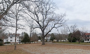
An image of Midlothian
More city maps of Virginia:
- Map of Roanoke
Roanoke, Virginia (established in 1852) is an independent city with 100 thousand residents, locate... - Map of Leesburg
Leesburg, Virginia (founded 1758) is a city with 53 thousand residents located about 40 miles nort... - Map of McLean
McLean, Virginia is a CDP and a suburb of Washington DC. It is famous for being a residence of man... - Map of Burke
Burke, Virginia is a census-designated place located in Fairfax County. The population of Burke ex... - Map of Danville
Danville is a nice independent city located on the southern edge of Virginia. Today Danville is ho... - Map of West Falls Church
West Falls Church, Virginia is a CDP located about 10 miles west of Washington, DC, in Fairfax Cou... - Map of Fredericksburg
Fredericksburg, Virginia is a shining independent city located about 47 miles south of Washington ... - Map of Tysons
Tysons, Virginia is a CDP situated 13 miles west of Washington DC, in Fairfax County. Founded in 1... - Map of Bailey's Crossroads
Bailey's Crossroads, Virginia is a cool suburban CDP located near Arlington, in Fairfax County. To... - Map of Chester
Chester, Virginia is an adorable CDP located in Chesterfield County. Dating back to 1900, today Ch... - Map of Brambleton
Brambleton, Virginia is a lovely CDP located in Loudoun County, about 34 miles west of Washington,... - Map of Kingstowne
Kingstowne is a planned community located in Fairfax County, Virginia. The population of Kingstown... - Map of Bon Air
Bon Air, Virginia is a suburban community located in Chesterfield County, in the central part of t... - Map of East Highland Park
East Highland Park, Virginia is a CDP located in Henrico County. The population of East Highland P... - Map of Hollins
Hollins is a census-designated place located in Roanoke County, Virginia. Hollins is home to 16 th... - Map of Highland Springs
Highland Springs, Virginia is an unincorporated community located in Henrico County. The populatio... - Map of Huntington
Huntington is a neighborhood located in Fairfax County, Virginia. Huntington is home to 14 thousan...
This online map of Midlothian, Virginia is provided by Bing Maps. Please add a bookmark and share the page with your friends!