The exact coordinates of Barre Vermont for your GPS track:
Latitude 44.19725 North, Longitude 72.501221 West.
ZIP codes for Barre:
05641
Please share the link with friends and neighbors:
Share on Facebook
Share on WhatsApp
Share on Telegram
Share on Facebook
Share on WhatsApp
Share on Telegram
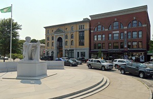
An image of Barre
More city maps of Vermont:
- Map of Milton
Milton is a town located in Chittenden County, Vermont. Today Milton, Vermont is populated by 11 t... - Map of Northfield
Northfield, Vermont is a beautiful city located in Washington County. Northfield is home to 6 thou... - Map of Lyndon
Lyndon, Vermont is a beautiful town located in Caledonia County. Lyndon is home to 6 thousand resi... - Map of Randolph
Randolph, Vermont is a wonderful town situated in Orange County. Today Randolph is populated by 5 ... - Map of Castleton
Castleton, Vermont is a lovely town located in Rutland County. Castleton is home to 4 thousand res...
This online map of Barre, Vermont is provided by Bing Maps. Please add a bookmark and share the page with your friends!