The exact coordinates of Burien Washington for your GPS track:
Latitude 47.466324 North, Longitude 122.339218 West.
Please share the link with friends and neighbors:
Share on Facebook
Share on WhatsApp
Share on Telegram
Share on Facebook
Share on WhatsApp
Share on Telegram
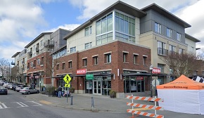
An image of Burien
More city maps of Washington:
- Map of Seattle
Seattle, Washington is the largest city in the state and the county seat of King County. It's loca... - Map of Spokane
Spokane is the second largest city in the state of Washington, located near its eastern border of ... - Map of Kent
Kent, Washington is a southern suburb of Seattle with 124 thousand inhabitants. Kent was founded i... - Map of Kirkland
Kirkland, Washington is a large eastern suburb of Seattle standing on the eastern coast of Lake Wa... - Map of Kennewick
Kennewick is a Council–manager city with 83 thousand residents, located in Benton County, on the... - Map of Redmond
Redmond, Washington is a city with 73 thousand residents, located about 15 miles northeast to Seat... - Map of Lynnwood
Lynnwood, Washington is a wonderful city situated about 16 miles north to downtown Seattle, in Sou... - Map of Mount Vernon
Mount Vernon, Washington (incorporated in 1889) is a stylish city and the county seat of Skagit Co... - Map of Des Moines
Des Moines, Washington is a wonderful city situated 15 miles south of Seattle, in King County. Fou... - Map of Moses Lake
Moses Lake, Washington is a charming city found in Grant County, about 177 miles east of Seattle. ... - Map of North Lynnwood
North Lynnwood, Washington is a dynamic CDP located 20 miles north of Seattle, in Snohomish County... - Map of Eastmont
Eastmont, Washington is a lovely CDP located 25 miles northeast of Seattle, in Snohomish County. E... - Map of Hazel Dell
Hazel Dell, Washington is a CDP situated near Vancouver, in Clark County. Today Hazel Dell is popu... - Map of Mill Creek
Mill Creek, Washington is a lovely city located 22 miles north of Seattle, in Snohomish County. Es... - Map of Ellensburg
Ellensburg, Washington is a lovely city located in Kittitas County. It stands in the central part ... - Map of Camano Island
Camano Island, Washington is a CDP located on a lovely island in Puget Sound, west of the city of ... - Map of White Center
White Center, Washington is a community located in King County, just south of Seattle, within the ...
Distances from Burien, Washington:
- Distance between Burien and Seattle
- Distance between Burien and Spokane
- Distance between Burien and Kent
- Distance between Burien and Kirkland
- Distance between Burien and Kennewick
- Distance between Burien and Redmond
- Distance between Burien and Lynnwood
- Distance between Burien and Mount Vernon
- Distance between Burien and Des Moines
- Distance between Burien and Moses Lake
- Distance between Burien and North Lynnwood
- Distance between Burien and Eastmont
- Distance between Burien and Hazel Dell
- Distance between Burien and Mill Creek
- Distance between Burien and Ellensburg
- Distance between Burien and Camano Island
- Distance between Burien and White Center
Full list of Washington maps
This online map of Burien, Washington is provided by Bing Maps. Please add a bookmark and share the page with your friends!