The exact coordinates of Olympia Washington for your GPS track:
Latitude 47.043625 North, Longitude 122.899147 West.
Please share the link with friends and neighbors:
Share on Facebook
Share on WhatsApp
Share on Telegram
Share on Facebook
Share on WhatsApp
Share on Telegram
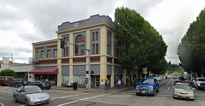
An image of Olympia
More city maps of Washington:
- Map of Yakima
Yakima, Washington is a city located in the southern part of the state. Its population exceeds 96 ... - Map of Auburn
Auburn, Washington is a city with 87 thousand residents, located about 30 miles south to downtown ... - Map of Edmonds
Edmonds, Washington is an excellent city located 17 miles north to downtown Seattle, in Snohomish ... - Map of Lake Stevens
Lake Stevens, Washington is a prominent city situated 35 miles north to Seattle, in Snohomish Coun... - Map of Wenatchee
Wenatchee, Washington is the county seat of Chelan County. Incorporated on February 29, 1892, toda... - Map of Pullman
Pullman, Washington is a stylish city standing about 75 miles south of Spokane, in Whitman County.... - Map of Tumwater
Tumwater, Washington is a lovely town located in Thurston County. Incorporated on November 25, 186... - Map of Bainbridge Island
Bainbridge Island, Washington is a shining city situated on an island in Kitsap County, west of Se... - Map of Bonney Lake
Bonney Lake, Washington is a wonderful city situated in Pierce County. Incorporated in 1949, today... - Map of Silverdale
Silverdale, Washington is a pleasant CDP found in Kitsap County, about 35 miles west of Seattle. T... - Map of Battle Ground
Battle Ground, Washington is a wonderful city situated near Vancouver, in Clark County. Today Batt... - Map of Arlington
Arlington, Washington is a pleasant city standing some 47 miles north of Seattle, in Snohomish Cou... - Map of Salmon Creek
Salmon Creek is a wonderful neighborhood located in Vancouver, Washington, which is part of the Po... - Map of Anacortes
Anacortes is a city located in Skagit County, Washington. It resides on Fidalgo Island, in the nor... - Map of West Richland
West Richland, Washington is a shining city located in Benton County. It stands in southeastern W... - Map of Ferndale
Ferndale is a city located in Whatcom County, Washington. It is situated in the northwest part of ... - Map of Snoqualmie
Snoqualmie, Washington is a city in King County, located in the western part of the state. The cit...
Distances from Olympia, Washington:
- Distance between Olympia and Yakima
- Distance between Olympia and Auburn
- Distance between Olympia and Edmonds
- Distance between Olympia and Lake Stevens
- Distance between Olympia and Wenatchee
- Distance between Olympia and Pullman
- Distance between Olympia and Tumwater
- Distance between Olympia and Bainbridge Island
- Distance between Olympia and Bonney Lake
- Distance between Olympia and Silverdale
- Distance between Olympia and Battle Ground
- Distance between Olympia and Arlington
- Distance between Olympia and Salmon Creek
- Distance between Olympia and Anacortes
- Distance between Olympia and West Richland
- Distance between Olympia and Ferndale
- Distance between Olympia and Snoqualmie
Full list of Washington maps
This online map of Olympia, Washington is provided by Bing Maps. Please add a bookmark and share the page with your friends!