The exact coordinates of Washougal Washington for your GPS track:
Latitude 45.578503 North, Longitude 122.352699 West.
Please share the link with friends and neighbors:
Share on Facebook
Share on WhatsApp
Share on Telegram
Share on Facebook
Share on WhatsApp
Share on Telegram
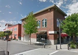
An image of Washougal
More city maps of Washington:
- Map of Vancouver
Vancouver, Washington (not to be confused with Vancouver, Canada) ... - Map of Federal Way
Federal Way, Washington, incorporated 1990, is a city inside Seattle metro area, located about 17 ... - Map of Sammamish
Sammamish, Washington (incorporated 1999) is a city located in Seattle area, on the eastern shores... - Map of Richland
Richland, Washington is a city located in the southern part of the state, on the eastern edge of B... - Map of Bothell
Bothell, Washington is a suburb of Seattle with 46 thousand inhabitants. It is located in King and... - Map of Bremerton
Bremerton, Washington is a remarkable coastal city located about 30 miles west to Seattle, in Kits... - Map of Parkland
Parkland, Washington is a nice CDP situated only 7 miles south to Tacoma, in Pierce County. Parkla... - Map of Walla Walla
Walla Walla, Washington is the seat of Walla Walla County. Founded in 1818, today Walla Walla is h... - Map of SeaTac
SeaTac, Washington is a charming city found midway between Seattle and Tacoma, in King County. The... - Map of Camas
Camas, Washington (incorporated 1906) is a dynamic suburban city of Portland, Oregon, found in Cla... - Map of Oak Harbor
Oak Harbor, Washington is an adorable island city located in Island County. Incorporated in 1915, ... - Map of Cottage Lake
Cottage Lake, Washington is a CDP located 20 miles northeast of Seattle, in King County. Today Cot... - Map of Frederickson
Frederickson, Washington is a CDP situated in Pierce County. Today Frederickson is populated by 22... - Map of Mountlake Terrace
Mountlake Terrace, Washington is a shining city, a suburb of Seattle located in Snohomish County. ... - Map of Monroe
Monroe, Washington is a hilarious city situated in Snohomish County. Incorporated on December 20, ... - Map of Five Corners
Five Corners, Washington is a census-designated place in Clark County. Today Five Corners is home ... - Map of Centralia
Centralia is a city located in Lewis County, Washington. It stands halfway between Seattle and Por...
Full list of Washington maps
This online map of Washougal, Washington is provided by Bing Maps. Please add a bookmark and share the page with your friends!