The exact coordinates of Fort Atkinson Wisconsin for your GPS track:
Latitude 42.929028 North, Longitude 88.837128 West.
Please share the link with friends and neighbors:
Share on Facebook
Share on WhatsApp
Share on Telegram
Share on Facebook
Share on WhatsApp
Share on Telegram
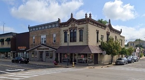
An image of Fort Atkinson
More city maps of Wisconsin:
- Map of Green Bay
Green Bay is the third largest city in Wisconsin, located some 112 miles north of Milwaukee.... - Map of Oshkosh
Oshkosh is located in central Wisconsin, on the western coast of Winnebago lake. The population of... - Map of La Crosse
La Crosse is a city on the western border of Wisconsin, located on the bank of Mississippi, with a... - Map of Menomonee Falls
Menomonee Falls, Wisconsin is a suburban village of Milwaukee, located in Waukesha County. Menomo... - Map of Manitowoc
Manitowoc, Wisconsin is a lakeside city located in Manitowoc County. Manitowoc is home to 35 thous... - Map of Neenah
Neenah, Wisconsin is a lakeside city in Winnebago County. The population of Neenah exceeds 28 thou... - Map of Caledonia
Caledonia, Wisconsin is an adorable village located in Racine County, about 20 miles south of Milw... - Map of Germantown
Germantown, Wisconsin is a charming village found in Washington County. The population of Germanto... - Map of Marshfield
Marshfield, Wisconsin is a lovely city located in Wood County. It is a vibrant community known for... - Map of Kaukauna
Kaukauna is a shining city situated in Outagamie County, along the Fox River in northeastern Wisco... - Map of Greendale
Greendale is a village located in Milwaukee County, Wisconsin. It is a planned community and was o... - Map of Whitewater
Whitewater is a city located in Walworth and Jefferson counties in the state of Wisconsin. The cit... - Map of Pewaukee
Pewaukee is a city located in Waukesha County, Wisconsin. It is a picturesque community known for ... - Map of Platteville
Platteville is a wonderful city found in Grant County, southwestern Wisconsin, and it is the count... - Map of Sussex
Sussex, Wisconsin is a wonderful village located in Waukesha County. It stands in the Lake Country... - Map of DeForest
DeForest, Wisconsin is a pleasant village located in Dane County. It stands in the southern part o... - Map of Sparta
Sparta, Wisconsin is a charming city that serves as the county seat of Monroe County. It stands in...
Full list of Wisconsin maps
This online map of Fort Atkinson, Wisconsin is provided by Bing Maps. Please add a bookmark and share the page with your friends!