The exact coordinates of Wauwatosa Wisconsin for your GPS track:
Latitude 43.050137 North, Longitude 88.006866 West.
Please share the link with friends and neighbors:
Share on Facebook
Share on WhatsApp
Share on Telegram
Share on Facebook
Share on WhatsApp
Share on Telegram
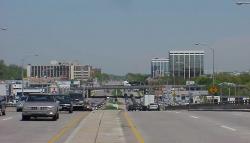
An image of Wauwatosa
More city maps of Wisconsin:
- Map of Waukesha
Waukesha is a city in southern Wisconsin with population of about 70 thousand people. It was chose... - Map of Fond du Lac
Fond du Lac, Wisconsin is a city on the southern shore of Lake Winnebago. Its population is over 4... - Map of Wausau
Wausau is a city situated in central Wisconsin, in Marathon County. Today Wausau is populated by 4... - Map of Sun Prairie
Sun Prairie, Wisconsin is a nice city situated near Madison, in Dane County. Today Sun Prairie is ... - Map of Mount Pleasant
Mount Pleasant, Wisconsin is a shining suburban village of Milwaukee, located in Racine County. To... - Map of Muskego
Muskego, Wisconsin is a hilarious city situated in Waukesha County. Incorporated in 1964, today Mu... - Map of Pleasant Prairie
Pleasant Prairie, Wisconsin is a lovely village located in Kenosha County. Founded in 1833, today ... - Map of Wisconsin Rapids
Wisconsin Rapids, Wisconsin is a wonderful city situated in Wood County. Wisconsin Rapids is known... - Map of Ashwaubenon
Ashwaubenon, Wisconsin is a pleasant village located in Brown County. It is a suburb of Green Bay,... - Map of Whitefish Bay
Whitefish Bay is a village located in Milwaukee County, Wisconsin. It is a charming and affluent c... - Map of Hudson
Hudson is a city located in St. Croix County, Wisconsin. It stands on the western border of Wiscon... - Map of Plover
Plover is a village located in Portage County, Wisconsin. It is a growing community known for its ... - Map of Brown Deer
Brown Deer, Wisconsin is a lovely village located in Milwaukee County. It sits in southeastern Wis... - Map of Grafton
Grafton is a village located in Ozaukee County, Wisconsin. It stands in southeastern Wisconsin, al... - Map of Waupun
Waupun is a city located in Dodge and Fond du Lac counties, Wisconsin. It stands in the southeaste... - Map of Burlington
Burlington, Wisconsin is an adorable city located in Racine County. It stands in the southeastern ... - Map of Elkhorn
Elkhorn, Wisconsin is a lovely city situated in Walworth County. It sits in the southeastern part ...
Distances from Wauwatosa, Wisconsin:
- Distance between Wauwatosa and Waukesha
- Distance between Wauwatosa and Fond du Lac
- Distance between Wauwatosa and Wausau
- Distance between Wauwatosa and Sun Prairie
- Distance between Wauwatosa and Mount Pleasant
- Distance between Wauwatosa and Muskego
- Distance between Wauwatosa and Pleasant Prairie
- Distance between Wauwatosa and Wisconsin Rapids
- Distance between Wauwatosa and Ashwaubenon
- Distance between Wauwatosa and Whitefish Bay
- Distance between Wauwatosa and Hudson
- Distance between Wauwatosa and Plover
- Distance between Wauwatosa and Brown Deer
- Distance between Wauwatosa and Grafton
- Distance between Wauwatosa and Waupun
- Distance between Wauwatosa and Burlington
- Distance between Wauwatosa and Elkhorn
Full list of Wisconsin maps
This online map of Wauwatosa, Wisconsin is provided by Bing Maps. Please add a bookmark and share the page with your friends!