Please share the link with friends and neighbors:
Share on Facebook
Share on WhatsApp
Share on Telegram
Share on Facebook
Share on WhatsApp
Share on Telegram
American Falls Reservoir is listed in:
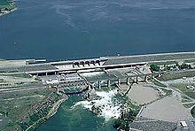
Image of American Falls Reservoir:
Check out some more famous and interesting places on our planet:
- Walker Lake
- Sardis Lake
- Lake Norman
- Cedar Creek Lake
- Lake Chelan
- Canyon Ferry Lake
- Norris Lake
- Lake Dardanelle
- Lake Kissimmee
- Grenada Lake
- Chickamauga Lake
- Elephant Butte Lake
- Lake Tawakoni
- Lake George
- Lake Lanier
- Lake Wallula
- Watts Bar Lake
- Lake Mattamuskeet
- Lake Ouachita
- Lake Vermilion
This satellite map of American Falls Reservoir is provided by Bing Maps.
Please add a bookmark and share the page with your friends!