Please share the link with friends and neighbors:
Share on Facebook
Share on WhatsApp
Share on Telegram
Share on Facebook
Share on WhatsApp
Share on Telegram
Easter Island is listed in:
Cool facts and FAQ about Easter Island:
What is Easter Island and where is it located?What are the Moai statues on Easter Island?
Who were the original inhabitants of Easter Island?
Why did the Easter Island civilization decline?
Is Easter Island inhabited today?
What language do people speak on Easter Island?
What is the main religion on Easter Island?
How do tourists visit Easter Island?
What makes Easter Island unique in world history?
What is the climate like on Easter Island?
Cool facts about Easter Island
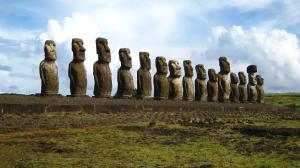
Image of Easter Island:
Check out some more famous and interesting places on our planet:
- Sandy Cay Reef
- Bougainville
- Heard Island
- Johnson South Reef
- Cuarteron Reef
- Taiping Island
- Pratas Island
- Subi Reef
- Triton Island
- Woody Island
- Scarborough Shoal
- Tristan da Cunha
- Eagle Island
- Hainan
- Komodo island
- Pelee Island
- Greenland
- Tenerife
- Governors Island
- New Caledonia
This online map of Easter Island is provided by OpenStreetMap.
Please add a bookmark and share the page with your friends!