Please share the link with friends and neighbors:
Share on Facebook
Share on WhatsApp
Share on Telegram
Share on Facebook
Share on WhatsApp
Share on Telegram
Fenway Park is listed in:
Cool facts and FAQ about Fenway Park:
What makes Fenway Park famous?Can you take a tour of Fenway Park?
What are the seating options at Fenway Park?
What kind of food can you get at Fenway Park?
Is Fenway Park only for baseball games?
Cool facts about Fenway Park
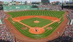
Image of Fenway Park:
Check out some more famous and interesting places on our planet:
- Legacy Arena
- PayPal Park
- Dick's Sporting Goods Park
- Children's Mercy Park
- Delaware Stadium
- Fargodome
- Ratliff Stadium
- Allianz Field
- Dana J Dykhouse Stadium
- Memorial Stadium at Bakersfield College
- Historic Crew Stadium
- Wailuku War Memorial Stadium
- Brooks Stadium
- SeatGeek Stadium
- Kimbrough Memorial Stadium
- Mesquite Memorial Stadium
- Roy Kidd Stadium
- Riccardo Silva Stadium
- Brown Stadium
- America First Field
This online map of Fenway Park is provided by OpenStreetMap.
Please add a bookmark and share the page with your friends!