Please share the link with friends and neighbors:
Share on Facebook
Share on WhatsApp
Share on Telegram
Share on Facebook
Share on WhatsApp
Share on Telegram
Kings Island is listed in:
Cool facts and FAQ about Kings Island:
What is Kings Island?What are the most famous roller coasters at Kings Island?
Are there water attractions at Kings Island?
Does Kings Island have entertainment shows?
What amenities are available at Kings Island?
Cool facts about Kings Island
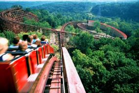
Image of Kings Island:
Check out some more famous and interesting places on our planet:
- Camp Mystic
- Downtown Disney
- Universal Studios Hollywood
- Santa Monica Pier
- Ain Dubai
- Kennywood Park
- Playland Amusement Park
- Black Rock City
- Six Flags Great Adventure
- Griffith Observatory
- Gulf State Park
- PIER 39
- Philadelphia Zoo
- Six Flags Discovery Kingdom
- Legoland California Resort
- Disneyland Park
- Cedar Point
- Yellowstone National Park
- Georgia Aquarium
- The London Eye
This online map of Kings Island is provided by OpenStreetMap.
Please add a bookmark and share the page with your friends!