Please share the link with friends and neighbors:
Share on Facebook
Share on WhatsApp
Share on Telegram
Share on Facebook
Share on WhatsApp
Share on Telegram
Windsor Castle is listed in:
Cool facts and FAQ about Windsor Castle:
What is Windsor Castle?Who lives in Windsor Castle?
When was Windsor Castle built?
Can the public visit Windsor Castle?
What is St. George's Chapel?
What events are held at Windsor Castle?
What makes Windsor Castle architecturally unique?
Why is Windsor Castle historically important?
Cool facts about Windsor Castle
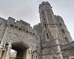
Image of Windsor Castle:
Check out some more famous and interesting places on our planet:
- Cabrillo National Monument
- Ferry Building
- Hearst Castle
- The Cannon House
- New York County Supreme Court
- The Tower of London
- Kensington Palace
- St James's Palace
- Westminster Abbey
- Balmoral Castle
- The sinking place of the Titanic
- Georgia Guidestones
- New York City Hall
- The Great Wall of China
- The Centennial Flame
- ByWard Market
- Phil's Burrow
- The Parliament of Canada
- The Statue of Unity
- Trevi Fountain
This online map of Windsor Castle is provided by OpenStreetMap.
Please add a bookmark and share the page with your friends!