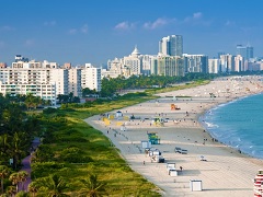
 Florida is a state located in the southeastern region of the United States. It is bordered by the Gulf of Mexico to the west, Alabama and Georgia to the north, and the Atlantic Ocean to the east. Florida is known for its warm climate and beaches, as well as its theme parks and tourist destinations such as Walt Disney World and Universal Studios. The state is also home to a diverse array of wildlife, including alligators, manatees, and panthers. Florida's economy is driven by tourism, agriculture, and international trade. The state capital is
 - Alachua
- Alafaya
- Altamonte Springs
- Apollo Beach
- Apopka
- Arcadia
- Asbury Lake
- Atlantic Beach
- Auburndale
- Ave Maria
- Aventura
- Avon Park
- Azalea Park
- Balm
- Bardmoor
- Bartow
- Bay Harbor Islands
- Bayonet Point
- Bayshore Gardens
- Beacon Square
- Bee Ridge
- Bellair
- Belle Glade
- Belle Isle
- Belleview
- Bellview
- Beverly Hills
- Bithlo
- Bloomingdale
- Boca Raton
- Bonita Springs
- Boynton Beach
- Bradenton
- Bradfordville
- Brandon
- Brent
- Broadview Park
- Brooksville
- Brownsville
- Buenaventura Lakes
- Callaway
- Cape Canaveral
- Cape Coral
- Carrollwood
- Casselberry
- Celebration
- Cheval
- Citrus Hills
- Citrus Park
- Citrus Springs
- Clearwater
- Clermont
- Clewiston
- Cocoa
- Cocoa Beach
- Cocoa West
- Coconut Creek
- Combee Settlement
- Connerton
- Conway
- Cooper City
- Coral Gables
- Coral Springs
- Coral Terrace
- Cortez
- Country Club
- Country Walk
- Crawfordville
- Crestview
- Crystal Lake
- Cutler Bay
- Cypress Gardens
- Cypress Lake
- Dade City
- Dania Beach
- Davie
- Daytona Beach
- Daytona Beach Shores
- DeBary
- Deerfield Beach
- DeFuniak Springs
- DeLand
- Delray Beach
- Deltona
- Destin
- Doctor Phillips
- Doral
- Dundee
- Dunedin
- East Lake
- East Lake-Orient Park
- East Milton
- Edgewater
- Egypt Lake-Leto
- Elfers
- Ellenton
- Englewood
- Ensley
- Estero
- Eustis
- Fairview Shores
- Fern Park
- Fernandina Beach
- Ferry Pass
- Fish Hawk
- Flagler Beach
- Fleming Island
- Florida City
- Florida Ridge
- Forest City
- Fort Lauderdale
- Fort Meade
- Fort Myers
- Fort Myers Beach
- Fort Myers Shores
- Fort Pierce
- Fort Pierce North
- Fort Walton Beach
- Fountainebleau
- Four Corners
- Freeport
- Fruit Cove
- Fruitland Park
- Fruitville
- Fuller Heights
- Gainesville
- Gateway
- Gibsonton
- Gladeview
- Glenvar Heights
- Golden Gate
- Golden Glades
- Goldenrod
- Gonzalez
- Goulds
- Green Cove Springs
- Greenacres
- Groveland
- Gulf Breeze
- Gulf Gate Estates
- Gulfport
- Haines City
- Hallandale Beach
- Heathrow
- Hernando
- Hialeah
- Hialeah Gardens
- High Springs
- Highland City
- Hobe Sound
- Holiday
- Holly Hill
- Hollywood
- Homestead
- Homosassa Springs
- Horizon West
- Hudson
- Hunters Creek
- Immokalee
- Indian Harbour Beach
- Indian River Estates
- Indiantown
- Inverness
- Inverness Highlands South
- Inwood
- Iona
- Islamorada
- Ives Estates
- Jacksonville
- Jacksonville Beach
- Jan Phyl Village
- Jasmine Estates
- Jensen Beach
- Jupiter
- Jupiter Farms
- Kathleen
- Kendale Lakes
- Kendall
- Kendall West
- Kenneth City
- Key Biscayne
- Key Largo
- Key West
- Keystone
- Kissimmee
- LaBelle
- Lady Lake
- Lake Alfred
- Lake Butler
- Lake City
- Lake Lorraine
- Lake Magdalene
- Lake Mary
- Lake Park
- Lake Wales
- Lake Worth Beach
- Lakeland
- Lakeland Highlands
- Lakeside
- Lakewood Park
- Lakewood Ranch
- Land o' Lakes
- Lantana
- Largo
- Lauderdale Lakes
- Lauderdale-by-the-Sea
- Lauderhill
- Laurel
- Lealman
- Lecanto
- Leesburg
- Lehigh Acres
- Leisure City
- Lely Resort
- Liberty Triangle
- Lighthouse Point
- Live Oak
- Lochmoor Waterway Estates
- Lockhart
- Longboat Key
- Longwood
- Loughman
- Lutz
- Lynn Haven
- Macclenny
- Maitland
- Mango
- Marathon
- Marco Island
- Margate
- Marianna
- Marion Oaks
- Mascotte
- McGregor
- Meadow Woods
- Medulla
- Melbourne
- Memphis
- Merritt Island
- Miami
- Miami Beach
- Miami Gardens
- Miami Lakes
- Miami Shores
- Miami Springs
- Micco
- Middleburg
- Midway
- Milton
- Mims
- Minneola
- Miramar
- Miramar Beach
- Mount Dora
- Mount Plymouth
- Myrtle Grove
- Naples
- Naples Manor
- Naples Park
- Naranja
- Navarre
- Neptune Beach
- New Port Richey
- New Port Richey East
- New Smyrna Beach
- Newberry
- Niceville
- Nocatee
- North Bay Village
- North Fort Myers
- North Lauderdale
- North Merritt Island
- North Miami
- North Miami Beach
- North Palm Beach
- North Port
- North Weeki Wachee
- Northdale
- Oak Ridge
- Oakland Park
- Oakleaf Plantation
- Ocala
- Ocean City
- Ocoee
- Odessa
- Ojus
- Okeechobee
- Oldsmar
- Olympia Heights
- On Top of the World
- Opa-locka
- Orange City
- Orange Park
- Orlando
- Orlovista
- Ormond Beach
- Ormond-by-the-Sea
- Osprey
- Oviedo
- Pace
- Pahokee
- Palatka
- Palm Bay
- Palm Beach
- Palm Beach Gardens
- Palm City
- Palm Coast
- Palm Harbor
- Palm River-Clair Mel
- Palm Springs
- Palm Springs North
- Palm Valley
- Palmer Ranch
- Palmetto
- Palmetto Bay
- Palmetto Estates
- Panama City
- Panama City Beach
- Parkland
- Pasadena Hills
- Pebble Creek
- Pelican Bay
- Pembroke Park
- Pembroke Pines
- Pensacola
- Pensacola Station
- Perry
- Pine Castle
- Pine Hills
- Pine Ridge
- Pinecrest
- Pinellas Park
- Pinewood
- Plant City
- Plantation
- Poinciana
- Pompano Beach
- Port Charlotte
- Port LaBelle
- Port Orange
- Port Saint Lucie
- Port Salerno
- Port St. John
- Princeton
- Progress Village
- Punta Gorda
- Quincy
- Richmond Heights
- Richmond West
- Rio Pinar
- River Park
- River Ridge
- Riverview
- Riviera Beach
- Rockledge
- Rotonda
- Royal Palm Beach
- Ruskin
- Safety Harbor
- Samsula-Spruce Creek
- San Carlos Park
- Sanford
- Sanibel
- Sarasota
- Sarasota Springs
- Satellite Beach
- Sebastian
- Sebring
- Seffner
- Seminole
- Shady Hills
- Siesta Key
- Silver Springs Shores
- Sky Lake
- South Apopka
- South Bradenton
- South Daytona
- South Gate Ridge
- South Highpoint
- South Miami
- South Miami Heights
- South Pasadena
- South Patrick Shores
- South Venice
- Southchase
- Southeast Arcadia
- Southgate
- Southwest Ranches
- Spring Hill
- Springfield
- St. Augustine
- St. Augustine Beach
- St. Augustine Shores
- St. Augustine South
- St. Cloud
- St. Pete Beach
- St. Petersburg
- Starke
- Stuart
- Sugarmill Woods
- Sun City Center
- Sunny Isles Beach
- Sunrise
- Sunset
- Surfside
- Sweetwater
- Tallahassee
- Tamarac
- Tamiami
- Tampa
- Tarpon Springs
- Tavares
- Temple Terrace
- Tequesta
- The Acreage
- The Crossings
- The Hammocks
- The Meadows
- The Villages
- Thonotosassa
- Three Lakes
- Three Oaks
- Tice
- Titusville
- Town 'n' Country
- Treasure Island
- Trinity
- Union Park
- University Park
- University West
- Upper Grand Lagoon
- Valparaiso
- Valrico
- Venice
- Vero Beach
- Vero Beach South
- Vero Lake Estates
- Viera East
- Viera West
- Villas
- Warm Mineral Springs
- Warrington
- Wedgefield
- Wekiwa Springs
- Wellington
- Wesley Chapel
- West Lealman
- West Little River
- West Melbourne
- West Miami
- West Palm Beach
- West Park
- West Pensacola
- West Perrine
- West Samoset
- West Vero Corridor
- Westchase
- Westchester
- Westgate
- Weston
- Westview
- Westwood Lakes
- Whiskey Creek
- Williamsburg
- Willow Oak
- Wilton Manors
- Wimauma
- Winter Garden
- Winter Haven
- Winter Park
- Winter Springs
- World Golf Village
- Wright
- Yulee
- Zephyrhills
- Zephyrhills South
- Zephyrhills West
List of counties in Florida:
- Alachua County
- Baker County
- Bay County
- Bradford County
- Brevard County
- Broward County
- Calhoun County
- Charlotte County
- Citrus County
- Clay County
- Collier County
- Columbia County
- DeSoto County
- Dixie County
- Duval County
- Escambia County
- Flagler County
- Franklin County
- Gadsden County
- Gilchrist County
- Glades County
- Gulf County
- Hamilton County
- Hardee County
- Hendry County
- Hernando County
- Highlands County
- Hillsborough County
- Holmes County
- Indian River County
- Jackson County
- Jefferson County
- Lafayette County
- Lake County
- Lee County
- Leon County
- Levy County
- Liberty County
- Madison County
- Manatee County
- Marion County
- Martin County
- Miami-Dade County
- Monroe County
- Nassau County
- Okaloosa County
- Okeechobee County
- Orange County
- Osceola County
- Palm Beach County
- Pasco County
- Pinellas County
- Polk County
- Putnam County
- Santa Rosa County
- Sarasota County
- Seminole County
- St. Johns County
- St. Lucie County
- Sumter County
- Suwannee County
- Taylor County
- Union County
- Volusia County
- Wakulla County
- Walton County
- Washington County