The exact coordinates of Whitney Nevada for your GPS track:
Latitude 36.096966 North, Longitude 115.04129 West.
Please share the link with friends and neighbors:
Share on Facebook
Share on WhatsApp
Share on Telegram
Share on Facebook
Share on WhatsApp
Share on Telegram
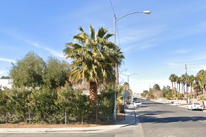
An image of Whitney
More city maps of Nevada:
- Map of North Las Vegas
North Las Vegas is the fourth largest city in Nevada, located in Las Vegas metro area. Today North... - Map of Carson City
Carson City, founded 1858, is the capital of Nevada and home for 54 thousand residents. It is loca... - Map of Mesquite
Mesquite, Nevada is a lovely city located 80 miles northeast of Las Vegas, in Clark County. Incorp... - Map of Gardnerville Ranchos
Gardnerville Ranchos is a CDP located in Douglas County, Nevada. It stands in the beautiful Carson...
Full list of Nevada maps
This online map of Whitney, Nevada is provided by Bing Maps. Please add a bookmark and share the page with your friends!