The exact coordinates of Garden City South Carolina for your GPS track:
Latitude 33.586933 North, Longitude 79.010857 West.
Please share the link with friends and neighbors:
Share on Facebook
Share on WhatsApp
Share on Telegram
Share on Facebook
Share on WhatsApp
Share on Telegram
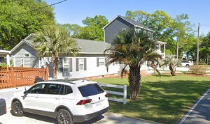
An image of Garden City
More city maps of South Carolina:
- Map of North Charleston
North Charleston is the third largest city in South Carolina, located, as its name hints, on the n... - Map of Mount Pleasant
Mount Pleasant, South Carolina is a town located in Charleston County. The population of Mount Ple... - Map of Florence
Florence, South Carolina is a wonderful city and the county seat of Florence County. Florence is h... - Map of Bluffton
Bluffton, South Carolina is a remarkable coastal town located in Beaufort County. Bluffton is popu... - Map of Mauldin
Mauldin, South Carolina is a nice city situated in Greenville County. The total population of Maul... - Map of Easley
Easley, South Carolina is an excellent city located near Greenville, in Pickens County. Easley is ... - Map of Hanahan
Hanahan, South Carolina is a wonderful city situated in Berkeley County, and is a suburb of Charle... - Map of Red Hill
Red Hill is a small community located in Horry County, South Carolina. It stands in the western pa... - Map of Lake Wylie
Lake Wylie, South Carolina is a lovely CDP located in York County. It's situated on the Catawba Ri... - Map of Moncks Corner
Moncks Corner, South Carolina is a shining town situated in Berkeley County. It stands north of Ch... - Map of Tega Cay
Tega Cay is a planned city located in York County, South Carolina. It stands on a peninsula along ...
Full list of South Carolina maps
This online map of Garden City, South Carolina is provided by Bing Maps. Please add a bookmark and share the page with your friends!