The exact coordinates of Tega Cay South Carolina for your GPS track:
Latitude 35.027615 North, Longitude 81.028816 West.
Please share the link with friends and neighbors:
Share on Facebook
Share on WhatsApp
Share on Telegram
Share on Facebook
Share on WhatsApp
Share on Telegram
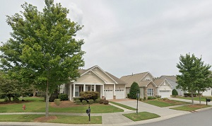
An image of Tega Cay
More city maps of South Carolina:
- Map of North Charleston
North Charleston is the third largest city in South Carolina, located, as its name hints, on the n... - Map of Mount Pleasant
Mount Pleasant, South Carolina is a town located in Charleston County. The population of Mount Ple... - Map of Florence
Florence, South Carolina is a wonderful city and the county seat of Florence County. Florence is h... - Map of Bluffton
Bluffton, South Carolina is a remarkable coastal town located in Beaufort County. Bluffton is popu... - Map of Mauldin
Mauldin, South Carolina is a nice city situated in Greenville County. The total population of Maul... - Map of Easley
Easley, South Carolina is an excellent city located near Greenville, in Pickens County. Easley is ... - Map of Hanahan
Hanahan, South Carolina is a wonderful city situated in Berkeley County, and is a suburb of Charle... - Map of Red Hill
Red Hill is a small community located in Horry County, South Carolina. It stands in the western pa... - Map of Lake Wylie
Lake Wylie, South Carolina is a lovely CDP located in York County. It's situated on the Catawba Ri... - Map of Moncks Corner
Moncks Corner, South Carolina is a shining town situated in Berkeley County. It stands north of Ch... - Map of Garden City
Garden City, South Carolina is an adorable coastal community located in Horry County. It stands al...
Full list of South Carolina maps
This online map of Tega Cay, South Carolina is provided by Bing Maps. Please add a bookmark and share the page with your friends!