Burlington is a city located in the province of Ontario, Canada. It stands on the northwestern shores of Lake Ontario and is part of the Greater Toronto Area (GTA). Burlington is nestled between Hamilton to the west and Oakville to the east. It covers an area of approximately 185 square kilometers and offers picturesque views of Lake Ontario and the Niagara Escarpment. Today Burlington is home to more than 164 thousand residents and growing fast. This map shows the detailed scheme of Burlington streets, including major sites and natural objecsts.
Zoom in or out, move the map's center by dragging your mouse or click the plus/minus buttons to zoom. Also check out a street view and a satellite map of Burlington.
The exact coordinates of Burlington, Canada for your GPS track:
Latitude 43.325825 North, Longitude 79.798126 West.
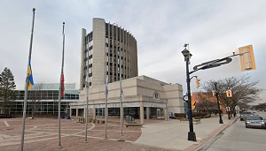
An image of Burlington, Canada:
Check out some more city maps in Canada:
Full list of Canada maps
This online map of Burlington (Canada) is provided by Bing Maps.
Please add a bookmark and share the page with your friends!